Area Overview for CW5 6DQ
Photos of CW5 6DQ

Area Information
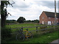
Living in CW5 6DQ means inhabiting a small, tightly knit residential cluster in the heart of Cheshire. With a population of 2,058 spread across 19 hectares, the area maintains a low density of 53 people per square kilometre, offering a quiet, semi-rural feel. Historically, Worleston was part of the ancient parish of Acton, and its village character persists today. The area is served by St Oswald’s Worleston CofE Primary School, a key anchor for families, and is within reach of multiple railway stations, including Nantwich and Crewe. While the population includes a significant proportion of young adults (15–29 years), the median age of 47 suggests a balance of established residents and newer arrivals. This is a place where proximity to nature and practical infrastructure coexist, with local shops and schools within walking distance. The small size of the area means a strong sense of community, though buyers should consider the limited housing stock and the need for nearby amenities.
- Area Type
- Postcode
- Area Size
- 19.0 hectares
- Population
- 2058
- Population Density
- 53 people/km²
The property market in CW5 6DQ is characterised by high home ownership (81%) and a focus on houses rather than flats or apartments. This suggests a market primarily driven by owner-occupiers seeking family homes or long-term investments. The small area size means the housing stock is limited, with few new developments likely to arise. Buyers should consider that the area’s proximity to railway stations and schools makes it appealing to families, though the limited number of properties may lead to competition. The predominance of houses, combined with the village’s semi-rural setting, may attract those prioritising space and a quieter lifestyle. However, the small size of the postcode area means buyers must look beyond its immediate boundaries for more extensive property options.
House Prices in CW5 6DQ
Showing 21 properties
Energy Efficiency in CW5 6DQ
The lifestyle in CW5 6DQ is shaped by its proximity to essential amenities, including five retail outlets such as Co-op Woolstanwood, Sainsburys Nantwich, and Morrisons Daily. These shops provide convenience for daily errands, though the area lacks large supermarkets or specialist stores. The village’s historical roots in agriculture are reflected in its open fields, though specific parks or leisure facilities are not detailed in the data. The three nearby railway stations enhance connectivity, allowing residents to access broader cultural and recreational opportunities. The mix of local shops and rail links supports a self-sufficient but modest lifestyle, ideal for those valuing simplicity and accessibility over sprawling urban conveniences.
Amenities
Schools
The educational landscape near CW5 6DQ includes St Oswald’s Worleston CofE Primary School, which serves the local community with a primary education offering and holds a ‘good’ Ofsted rating. Reaseheath College, a sixth-form provider, is also accessible, though no secondary schools are listed in the data. This combination of primary and post-16 education means families may need to travel further for secondary schooling, but the primary school’s strong rating is a significant draw for parents. The absence of a comprehensive school within the postcode suggests that families should evaluate the broader regional school network when considering the area. The presence of a sixth-form college, however, provides a pathway for local students pursuing higher education without leaving the region.
| Rank | School | Type | Entry gender | Ages |
|---|
Explore more schools in this area
Go to Schools tabDemographics
The community in CW5 6DQ is predominantly composed of homeowners, with 81% of properties occupied by their owners. This high rate of home ownership suggests a stable, long-term resident base. The area’s accommodation is largely houses, which aligns with the low population density and the village’s traditional layout. The median age of 47 indicates a mature demographic, though the most common age range is young adults (15–29 years), hinting at a mix of family households and younger professionals. The predominant ethnic group is White, and while specific data on deprivation is not provided, the low crime risk and presence of essential amenities suggest a reasonably comfortable quality of life. The area’s small size and limited housing options may mean fewer rental properties, making it a place where long-term residency is more common than short-term tenancies.
Household Size
Accommodation Type
Tenure
Ethnic Group
Religion
Household Composition
Age
Household Deprivation
NS-SEC
Explore more demographic insights in this area
Go to Demographics tabPlanning
Planning Constraints
- Flood RiskPremium
- Ramsar Wetland SitesPremium
- Area of Outstanding Natural BeautyPremium
- Protected Nature ReservePremium
- Protected WoodlandPremium