Area Overview for CW5 6DN
Photos of CW5 6DN
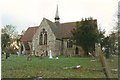

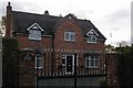
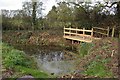
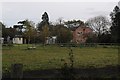
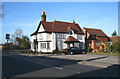

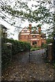
11 photos from this area
Area Information
Key information about the CW5 6DN including its size, population, and administrative classification.
- Area Type
- Postcode
- Area Size
- 83.9 hectares
- Population
- 2058
- Population Density
- 53 people/km²
House Prices in CW5 6DN
65
Properties
£299,498
Average Sold Price
£38,000
Lowest Price
£700,000
Highest Price
Showing 65 properties
| Address | Type | Beds | Baths | Last Sale Price | Last Sale Date | |
|---|---|---|---|---|---|---|
| 95 Main Road, Worleston, CW5 6DN | Detached | 4 | 2 | £429,500 | Apr 2025 | |
| 116 Main Road, Worleston, CW5 6DN | Detached | 5 | 2 | £500,000 | Oct 2024 | |
| 74 Main Road, Worleston, CW5 6DN | Bungalow | - | - | £225,000 | Mar 2024 | |
| 87 Main Road, Worleston, CW5 6DN | Semi-detached | 2 | 1 | £205,000 | Jul 2023 | |
| 93 Main Road, Worleston, CW5 6DN | Terraced | 2 | 1 | £215,000 | Jan 2023 | |
| 76 Main Road, Worleston, CW5 6DN | Retail | 3 | 1 | £260,000 | Oct 2021 | |
| 122 Main Road, Worleston, CW5 6DN | Semi-detached | 3 | 1 | £180,000 | Aug 2019 | |
| 86 Main Road, Worleston, CW5 6DN | Detached | 4 | 3 | £325,000 | Jul 2019 | |
| 88 Main Road, Worleston, CW5 6DN | house | - | - | £239,950 | Jul 2019 | |
| 80 Main Road, Worleston, CW5 6DN | house | - | - | £255,000 | Mar 2017 |
Page 1 of 7
Energy Efficiency in CW5 6DN
Amenities
Schools
| Rank | School | Type | Entry gender | Ages |
|---|
Explore more schools in this area
Go to Schools tabDemographics
Household Size
Two person
most common
Accommodation Type
Houses
most common
Tenure
81
majority
Ethnic Group
White
most common
Religion
N/A
most common
Household Composition
N/A
most common
Age
47
median
Young Adults (15-29 years)
most common
Household Deprivation
N/A
with no deprivation
NS-SEC
29
in Lower managerial occupations
Explore more demographic insights in this area
Go to Demographics tabPlanning
Planning Constraints
- Flood RiskPremium
- Ramsar Wetland SitesPremium
- Area of Outstanding Natural BeautyPremium
- Protected Nature ReservePremium
- Protected WoodlandPremium