Area Overview for CW2 8SY
Photos of CW2 8SY

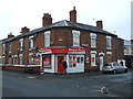
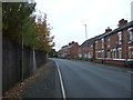
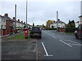
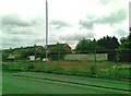
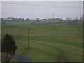
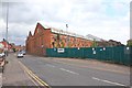
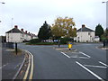
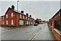
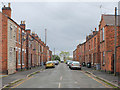
17 photos from this area
Area Information
Key information about the CW2 8SY including its size, population, and administrative classification.
- Area Type
- Postcode
- Area Size
- 7352 m²
- Population
- 1375
- Population Density
- 631 people/km²
House Prices in CW2 8SY
12
Properties
£91,363
Average Sold Price
£25,950
Lowest Price
£166,500
Highest Price
Showing 12 properties
| Address | Type | Beds | Baths | Last Sale Price | Last Sale Date | |
|---|---|---|---|---|---|---|
| 52 Sunnybank Road, Crewe, CW2 8SY | Semi-detached | 2 | 1 | £166,500 | Jul 2025 | |
| 46 Sunnybank Road, Crewe, CW2 8SY | Semi-detached | 2 | 1 | £140,000 | Mar 2020 | |
| 43 Sunnybank Road, Crewe, CW2 8SY | Semi-detached | 2 | 1 | £25,950 | Oct 1996 | |
| 50 Sunnybank Road, Crewe, CW2 8SY | Semi-detached | - | - | £33,000 | Sep 1996 | |
| 53 Sunnybank Road, Crewe, CW2 8SY | Semi-detached | 3 | 1 | - | - | |
| 55 Sunnybank Road, Crewe, CW2 8SY | house | - | - | - | - | |
| Tennis 100M From 1 Burlea Close 23M From Sunnybank Road, Sunnybank Road, Crewe, CW2 8SY | Leisure | - | - | - | - | |
| 45 Sunnybank Road, Crewe, CW2 8SY | house | - | - | - | - | |
| 47 Sunnybank Road, Crewe, CW2 8SY | house | - | - | - | - | |
| 51 Sunnybank Road, Crewe, CW2 8SY | house | - | - | - | - |
Page 1 of 2
Energy Efficiency in CW2 8SY
Amenities
Schools
| Rank | School | Type | Entry gender | Ages |
|---|
Explore more schools in this area
Go to Schools tabDemographics
Household Size
Two person
most common
Accommodation Type
Houses
most common
Tenure
60
majority
Ethnic Group
White
most common
Religion
N/A
most common
Household Composition
N/A
most common
Age
47
median
Adults (30-64 years)
most common
Household Deprivation
N/A
with no deprivation
NS-SEC
21
in Lower managerial occupations
Explore more demographic insights in this area
Go to Demographics tabPlanning
Planning Constraints
- Flood RiskPremium
- Ramsar Wetland SitesPremium
- Area of Outstanding Natural BeautyPremium
- Protected Nature ReservePremium
- Protected WoodlandPremium