Area Overview for CW2 8SP
Photos of CW2 8SP
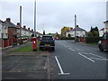
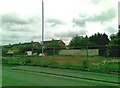
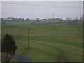
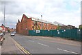
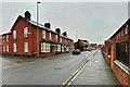
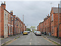
17 photos from this area
Area Information
Key information about the CW2 8SP including its size, population, and administrative classification.
- Area Type
- Postcode
- Area Size
- 1.9 hectares
- Population
- 1375
- Population Density
- 1737 people/km²
House Prices in CW2 8SP
40
Properties
£116,466
Average Sold Price
£44,000
Lowest Price
£212,500
Highest Price
Showing 40 properties
| Address | Type | Beds | Baths | Last Sale Price | Last Sale Date | |
|---|---|---|---|---|---|---|
| 25 Merrills Avenue, Crewe, CW2 8SP | Semi-detached | 2 | 1 | £212,500 | Dec 2025 | |
| 55 Merrills Avenue, Crewe, CW2 8SP | Bungalow | 1 | 2 | £180,000 | Oct 2024 | |
| 83 Merrills Avenue, Crewe, CW2 8SP | Bungalow | - | - | £170,000 | Feb 2023 | |
| 67 Merrills Avenue, Crewe, CW2 8SP | Semi-detached | 2 | 1 | £168,500 | Aug 2021 | |
| 45 Merrills Avenue, Crewe, CW2 8SP | Bungalow | - | - | £127,500 | Apr 2019 | |
| 85 Merrills Avenue, Crewe, CW2 8SP | Bungalow | 3 | - | £127,250 | Feb 2019 | |
| 6 Merrills Avenue, Crewe, CW2 8SP | Semi-detached | 3 | 2 | £160,000 | Oct 2017 | |
| 77 Merrills Avenue, Crewe, CW2 8SP | Bungalow | - | - | £124,995 | Jun 2016 | |
| 87 Merrills Avenue, Crewe, CW2 8SP | Bungalow | 3 | - | £122,500 | Mar 2016 | |
| 49 Merrills Avenue, Crewe, CW2 8SP | Bungalow | 2 | 1 | £113,950 | Jan 2016 |
Page 1 of 4
Energy Efficiency in CW2 8SP
Amenities
Schools
| Rank | School | Type | Entry gender | Ages |
|---|
Explore more schools in this area
Go to Schools tabDemographics
Household Size
Two person
most common
Accommodation Type
Houses
most common
Tenure
73
majority
Ethnic Group
White
most common
Religion
N/A
most common
Household Composition
N/A
most common
Age
47
median
Adults (30-64 years)
most common
Household Deprivation
N/A
with no deprivation
NS-SEC
23
in Lower managerial occupations
Explore more demographic insights in this area
Go to Demographics tabPlanning
Planning Constraints
- Flood RiskPremium
- Ramsar Wetland SitesPremium
- Area of Outstanding Natural BeautyPremium
- Protected Nature ReservePremium
- Protected WoodlandPremium