Area Overview for CW2 5SW
Photos of CW2 5SW
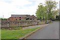
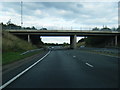
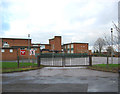
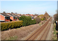
24 photos from this area
Area Information
Key information about the CW2 5SW including its size, population, and administrative classification.
- Area Type
- Postcode
- Area Size
- 2.3 hectares
- Population
- 1256
- Population Density
- 682 people/km²
House Prices in CW2 5SW
43
Properties
£261,235
Average Sold Price
£179,950
Lowest Price
£354,950
Highest Price
Showing 43 properties
| Address | Type | Beds | Baths | Last Sale Price | Last Sale Date | |
|---|---|---|---|---|---|---|
| 38 Broomhall Drive, Shavington, CW2 5SW | Semi-detached | 3 | 2 | £245,000 | Jun 2025 | |
| 2 Broomhall Drive, Shavington, CW2 5SW | Detached | 4 | 3 | £320,000 | Jun 2025 | |
| 10 Broomhall Drive, Shavington, CW2 5SW | Detached | 3 | 2 | £265,000 | Mar 2025 | |
| 51 Broomhall Drive, Shavington, CW2 5SW | Detached | 4 | 3 | £350,000 | Jul 2023 | |
| 7 Broomhall Drive, Shavington, CW2 5SW | Detached | 4 | 2 | £284,950 | Nov 2021 | |
| 15 Broomhall Drive, Shavington, CW2 5SW | Detached | 5 | 1 | £345,050 | Mar 2021 | |
| 6 Broomhall Drive, Shavington, CW2 5SW | Detached | 3 | 2 | £195,000 | Feb 2020 | |
| 3 Broomhall Drive, Shavington, CW2 5SW | house | 4 | 2 | £264,950 | Jun 2019 | |
| 40 Broomhall Drive, Shavington, CW2 5SW | Semi-detached | 3 | 2 | £189,950 | Jun 2019 | |
| 1 Broomhall Drive, Shavington, CW2 5SW | Semi-detached | 3 | 3 | £339,950 | May 2019 |
Page 1 of 5
Energy Efficiency in CW2 5SW
Amenities
Schools
| Rank | School | Type | Entry gender | Ages |
|---|
Explore more schools in this area
Go to Schools tabDemographics
Household Size
Two person
most common
Accommodation Type
Houses
most common
Tenure
91
majority
Ethnic Group
White
most common
Religion
N/A
most common
Household Composition
N/A
most common
Age
47
median
Adults (30-64 years)
most common
Household Deprivation
N/A
with no deprivation
NS-SEC
47
in Lower managerial occupations
Explore more demographic insights in this area
Go to Demographics tabPlanning
Planning Constraints
- Flood RiskPremium
- Ramsar Wetland SitesPremium
- Area of Outstanding Natural BeautyPremium
- Protected Nature ReservePremium
- Protected WoodlandPremium