Area Overview for CW2 5DL
Photos of CW2 5DL
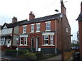
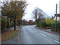
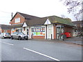
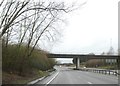
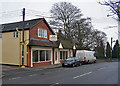
12 photos from this area
Area Information
Key information about the CW2 5DL including its size, population, and administrative classification.
- Area Type
- Postcode
- Area Size
- 2.3 hectares
- Population
- 2714
- Population Density
- 974 people/km²
House Prices in CW2 5DL
31
Properties
£184,553
Average Sold Price
£50,000
Lowest Price
£355,000
Highest Price
Showing 31 properties
| Address | Type | Beds | Baths | Last Sale Price | Last Sale Date | |
|---|---|---|---|---|---|---|
| 123 Crewe Road, Shavington, CW2 5DL | Semi-detached | 3 | 1 | £232,000 | Dec 2025 | |
| 133 Crewe Road, Shavington, CW2 5DL | Semi-detached | 3 | 1 | £248,000 | Dec 2024 | |
| 118 Crewe Road, Shavington, CW2 5DL | Semi-detached | 3 | 1 | £250,000 | Dec 2023 | |
| 130 Crewe Road, Shavington, CW2 5DL | house | 3 | - | £263,000 | Apr 2021 | |
| 125 Crewe Road, Shavington, CW2 5DL | Semi-detached | 4 | 2 | £232,000 | Jun 2020 | |
| 140 Crewe Road, Shavington, CW2 5DL | Detached | 5 | 2 | £355,000 | Jun 2020 | |
| 141 Crewe Road, Shavington, CW2 5DL | Semi-detached | 4 | 1 | £255,000 | Apr 2019 | |
| 136 Crewe Road, Shavington, CW2 5DL | Semi-detached | - | - | £190,000 | Sep 2014 | |
| 122 Crewe Road, Shavington, CW2 5DL | Semi-detached | 3 | 1 | £168,000 | Apr 2014 | |
| 155 Crewe Road, Shavington, CW2 5DL | Bungalow | - | - | £135,000 | Dec 2010 |
Page 1 of 4
Energy Efficiency in CW2 5DL
Amenities
Schools
| Rank | School | Type | Entry gender | Ages |
|---|
Explore more schools in this area
Go to Schools tabDemographics
Household Size
Two person
most common
Accommodation Type
Houses
most common
Tenure
84
majority
Ethnic Group
White
most common
Religion
N/A
most common
Household Composition
N/A
most common
Age
47
median
Adults (30-64 years)
most common
Household Deprivation
N/A
with no deprivation
NS-SEC
41
in Lower managerial occupations
Explore more demographic insights in this area
Go to Demographics tabPlanning
Planning Constraints
- Flood RiskPremium
- Ramsar Wetland SitesPremium
- Area of Outstanding Natural BeautyPremium
- Protected Nature ReservePremium
- Protected WoodlandPremium