Area Overview for CW11 1TR
Photos of CW11 1TR

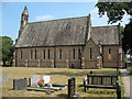
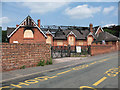
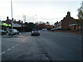
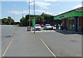
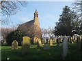
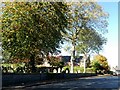

18 photos from this area
Area Information
Key information about the CW11 1TR including its size, population, and administrative classification.
- Area Type
- Postcode
- Area Size
- 7631 m²
- Population
- 1288
- Population Density
- 1113 people/km²
House Prices in CW11 1TR
20
Properties
£138,330
Average Sold Price
£50,000
Lowest Price
£227,500
Highest Price
Showing 20 properties
| Address | Type | Beds | Baths | Last Sale Price | Last Sale Date | |
|---|---|---|---|---|---|---|
| 3 Pickmere Close, Sandbach, CW11 1TR | Bungalow | - | - | £227,500 | Sep 2022 | |
| 4 Pickmere Close, Sandbach, CW11 1TR | Bungalow | - | - | £155,000 | Oct 2017 | |
| 17 Pickmere Close, Sandbach, CW11 1TR | Bungalow | 2 | 1 | £165,000 | Oct 2017 | |
| 16 Pickmere Close, Sandbach, CW11 1TR | Semi-detached | 2 | 2 | £150,000 | Jan 2017 | |
| 9 Pickmere Close, Sandbach, CW11 1TR | Semi-detached | 2 | - | £149,950 | Sep 2014 | |
| 1 Pickmere Close, Sandbach, CW11 1TR | Bungalow | 2 | - | £136,000 | Dec 2011 | |
| 18 Pickmere Close, Sandbach, CW11 1TR | house | - | - | £150,000 | Dec 2008 | |
| 7 Pickmere Close, Sandbach, CW11 1TR | Semi-detached | - | - | £142,950 | May 2005 | |
| 13 Pickmere Close, Sandbach, CW11 1TR | house | - | - | £137,225 | Apr 2005 | |
| 15 Pickmere Close, Sandbach, CW11 1TR | Semi-detached | - | - | £58,000 | Sep 1999 |
Page 1 of 2
Energy Efficiency in CW11 1TR
Amenities
Schools
| Rank | School | Type | Entry gender | Ages |
|---|
Explore more schools in this area
Go to Schools tabDemographics
Household Size
Two person
most common
Accommodation Type
Houses
most common
Tenure
94
majority
Ethnic Group
White
most common
Religion
N/A
most common
Household Composition
N/A
most common
Age
47
median
Adults (30-64 years)
most common
Household Deprivation
N/A
with no deprivation
NS-SEC
37
in Lower managerial occupations
Explore more demographic insights in this area
Go to Demographics tabPlanning
Planning Constraints
- Flood RiskPremium
- Ramsar Wetland SitesPremium
- Area of Outstanding Natural BeautyPremium
- Protected Nature ReservePremium
- Protected WoodlandPremium