Area Overview for CW11 1WR
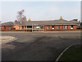
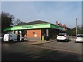
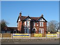
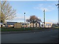
Photos of CW11 1WR


Area Information
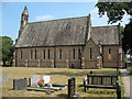
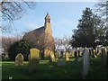
Living in CW11 1WR means being part of a small, tightly knit residential cluster in Sandbach, a market town in Cheshire East. With a population of 1,288 and a density of 1,113 people per square kilometre, this area is compact yet rich in history. Sandbach’s origins trace back to the Domesday Book of 1086, with its market charter granted by Queen Elizabeth I in 1579. Today, the town retains its charm through features like the Anglo-Saxon Sandbach Crosses, reassembled in 1816, and the Thursday market held in the town square. The area is served by nearby railway stations, including Sandbach and Crewe, linking residents to broader networks. Daily life here balances historical character with modern convenience, from the monthly Farmers’ Market to shops like Co-op Elworth. The predominantly older adult population, many of whom own their homes, contributes to a stable, community-oriented atmosphere. CW11 1WR is ideal for those seeking a quiet, historic town with practical transport links and a strong sense of local identity.
- Area Type
- Postcode
- Area Size
- Not available
- Population
- 1288
- Population Density
- 1113 people/km²
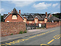
The property market in CW11 1WR is characterised by high home ownership, with 94% of residents living in owner-occupied homes. This suggests a stable, long-term market with limited rental activity, as the area is primarily composed of houses rather than flats or apartments. Given the small size of the postcode area, the housing stock is likely limited, with properties concentrated in the town’s residential clusters. Buyers should consider that the market is not geared toward investors seeking rental income but rather to those prioritising ownership in a historic, low-density setting. The prevalence of houses, combined with the area’s compact nature, means properties are likely to be family homes with established gardens or outdoor space. Prospective buyers should also note that the area’s small size may limit availability, requiring a focused search within Sandbach and its immediate surroundings.
House Prices in CW11 1WR
No properties found in this postcode.
Energy Efficiency in CW11 1WR
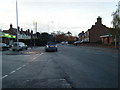
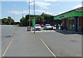
Life in CW11 1WR is shaped by its proximity to Sandbach’s amenities, including five retail outlets such as Co-op Elworth and Aldi Arclid, offering everyday essentials. The Thursday market, held on Scotch Common, and the monthly Farmers’ Market provide opportunities to engage with local producers and enjoy a traditional town centre atmosphere. The area’s historical character is evident in landmarks like the Sandbach Crosses, managed by English Heritage, and St Mary’s Church, which houses ancient stone fragments. Residents can also access rail services at Sandbach and Crewe stations, connecting them to broader regional networks. The compact nature of the postcode area means amenities are within practical reach, fostering a convenient, walkable lifestyle. Whether shopping, dining, or exploring heritage sites, CW11 1WR offers a blend of practicality and charm that appeals to those valuing both convenience and history.
Amenities
Schools
| Rank | School | Type | Entry gender | Ages |
|---|
Explore more schools in this area
Go to Schools tabDemographics
The community in CW11 1WR is predominantly composed of adults aged 30–64, with a median age of 47. This reflects a mature demographic, with 94% of residents owning their homes, a figure significantly higher than the national average. The area is largely composed of houses, not flats, indicating a traditional, family-oriented housing stock. The predominant ethnic group is White, aligning with broader regional trends. With a population density of 1,113 people per square kilometre, the area is neither sprawling nor overly congested, offering a balance between space and proximity to amenities. The high home ownership rate suggests long-term residency and stability, while the age profile indicates a community focused on established living rather than transient populations. This demographic structure supports a cohesive, low-turnover environment, where local institutions and traditions hold strong influence.
Household Size
Accommodation Type
Tenure
Ethnic Group
Religion
Household Composition
Age
Household Deprivation
NS-SEC
Explore more demographic insights in this area
Go to Demographics tabPlanning
Planning Constraints
- Flood RiskPremium
- Ramsar Wetland SitesPremium
- Area of Outstanding Natural BeautyPremium
- Protected Nature ReservePremium
- Protected WoodlandPremium