Area Overview for CW1 6DL
Photos of CW1 6DL


Area Information
Living in CW1 6DL offers a settled residential experience within the small cluster of Crewe Green, located about one and a half miles east of Crewe town centre. This specific postcode covers an area of just 5,296 square metres, creating a very compact community environment. The location was historically significant as the seat of the de Crewe family before becoming a separate ecclesiastical parish in 1857 and later adopting the name Crewe Green in 1984 to distinguish it from the town. Today, the area encompasses dispersed houses alongside agricultural land at Slaughter Hill and the historic site of Crewe Hall. You will find your nearest house roughly 0.8 miles from Crewe railway station, which sits just across the parish boundary. The landscape is defined by the Crewe–Alsager railway line and the B5077 road running east-west, while Valley Brook and Englesea Brook cross the neighbourhood. Over 700 homes in Crewe Green offer a quiet alternative to immediate town life, yet the area remains accessible to key facilities. The precise coordinates sit at approximately 53.089331, -2.431667, marking a distinct spot within Cheshire East where rural features meet local connectivity.
- Area Type
- Postcode
- Area Size
- 5296 m²
- Population
- 1516
- Population Density
- 1072 people/km²
The property market in CW1 6DL is defined by a strong presence of homeownership rather than a rental-led economy. With 69 per cent of households owning their properties, the area functions primarily as a settled housing market. The predominant accommodation type is houses, which aligns with the area's description as comprising dispersed dwellings and historic farms. This contrasts sharply with high-density urban postcodes where flats and apartments dominate. Buyers looking at homes in CW1 6DL should anticipate accessing traditional housing stock rather than new-build developments or purpose-built rental schemes. The small total area size of 5,296 square metres limits the volume of available inventory, meaning competition may be higher among those seeking specific properties within this narrow band. The high ownership rate often implies stable local valuations driven by resident desire rather than speculative investment. Since the area is part of a former civil parish now merged into Weston and Crewe Green, your search might extend to neighbouring properties outside the exact boundary to find more variety. However, the core character remains consistent: a low-density, owner-occupied setting dominated by houses that has stood since the Jacobean era.
House Prices in CW1 6DL
No properties found in this postcode.
Energy Efficiency in CW1 6DL
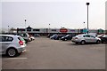
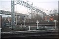
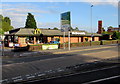
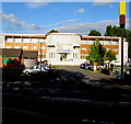
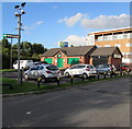
Residents of CW1 6DL enjoy convenient access to a small range of retail and transport hubs within practical reach. There are five key retail outlets available to support your shopping needs, including Iceland Crewe, M&S Grand, and Morrisons Daily. These major chains provide essential groceries and clothing without requiring a long drive into town. For travel, the area is well-positioned near four railway stations, including Crewe Railway Station, Sandbach Railway Station, and Nantwich Railway Station. Crewe Railway Station stands out as the primary interchange for regional and national rail services. The lifestyle here balances village quiet with town convenience. St Michael and All Angels Church anchors the local community character in Crewe Green village. You can also visit the grade-I-listed Crewe Hall, which now operates as a hotel and restaurant, or explore the extensive 201 hectares of grade II-listed parkland including Rookery Wood and Temple of Peace Wood. The area features industrial spaces like Crewe Hall Enterprise Park and Crewe Hall Farm, adding to the local economy. The historic Jacobean stables quadrangle from around 1636 offers cultural interest. Daily life involves short trips to local shops and easy rail access to broader destinations.
Amenities
Schools
Families living in CW1 6DL have access to two primary institutions for their children's education. Hungerford Primary School and Hungerford Primary Academy both serve the local catchment area. Recent Ofsted data identifies Hungerford Primary Academy with a satisfactory rating. Both schools operate at the primary level, meaning you will not find secondary schools listed within the immediate vicinity of this specific postcode. This mix indicates a need for national or local secondary placement once children grow beyond primary age. The presence of an academy with a specific Ofsted rating provides a clear indicator of educational standards for primary-aged children living near Crewe Green. Parents should note that the data confirms these as the only nearby primary options listed for this location. The proximity of these two institutions suggests a structured approach to primary education in the immediate neighbourhood. While secondary choices are not detailed in the local data, the primary options offer a consistent educational pathway. The area does not feature specialist or comprehensive schools within the immediate immediate reach, focusing instead on foundational learning within the established village cluster.
| Rank | School | Type | Entry gender | Ages |
|---|
Explore more schools in this area
Go to Schools tabDemographics
The community in CW1 6DL reflects a mature, predominantly owner-occupied population. Data indicates a median age of 47 years, with adults aged between 30 and 64 forming the most common age range. This demographic profile suggests a neighbourhood characterised by stability and long-term residency rather than transient renting. A striking 69 per cent of households here own their homes, significantly higher than the national average. Those living in CW1 6DL primarily reside in houses, aligning with the area's residential and historic nature. The population density averages 1,072 people per square kilometre, indicating a balance between lived density and open space. While the predominant ethnic group is White, the area functions as a standard residential part of Crewe Green without the data suggesting significant demographic shifts. The neighbourhood feels established, with the majority of residents falling into the prime working or mature years bracket. This stability makes the area appealing for families seeking roots or professionals looking for a quiet place to live away from the immediate bustle of the town centre. The high level of home ownership suggests that residents are invested in the community's upkeep and character.
Household Size
Accommodation Type
Tenure
Ethnic Group
Religion
Household Composition
Age
Household Deprivation
NS-SEC
Explore more demographic insights in this area
Go to Demographics tabPlanning
Planning Constraints
- Flood RiskPremium
- Ramsar Wetland SitesPremium
- Area of Outstanding Natural BeautyPremium
- Protected Nature ReservePremium
- Protected WoodlandPremium