Area Overview for CW1 1GU
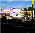
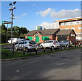
Photos of CW1 1GU


Area Information
CW1 1GU is a small residential postcode area in Cheshire East, England, located approximately 1.5 miles east of Crewe town centre. With a population of 1,516 and a density of 1,072 people per square kilometre, it reflects a compact, tightly knit community. The area blends rural charm with proximity to urban amenities, situated near Crewe Hall, a historic Jacobean mansion, and industrial estates such as Crewe Hall Enterprise Park. This postcode encompasses a mix of dispersed housing, farms, and green spaces, offering a quiet yet connected lifestyle. Residents benefit from being close to Crewe’s town centre, which provides access to services, transport, and cultural hubs. The area’s history as part of the former civil parish of Crewe Green adds a layer of local heritage, with notable landmarks like St Michael and All Angels Church and grade-II-listed parkland. Living here means balancing the tranquillity of a smaller village with the convenience of nearby infrastructure, making it appealing to those seeking a stable, community-focused environment.
- Area Type
- Postcode
- Area Size
- Not available
- Population
- 1516
- Population Density
- 1072 people/km²
The property market in CW1 1GU is dominated by owner-occupied homes, with 69% of properties owned outright. This high rate of home ownership suggests a stable, long-term resident base and limited rental activity. The accommodation type is predominantly houses, which is typical of smaller, residential areas with a suburban or semi-rural feel. This housing stock caters to families and individuals seeking space and privacy, though the small size of the postcode means the market is limited in scale. Buyers should consider the proximity to Crewe’s town centre and surrounding infrastructure, which may influence property values. The presence of industrial estates nearby, such as Crewe Hall Enterprise Park, could also impact local property dynamics, though residential areas remain distinct from commercial zones. For buyers, the focus on owner-occupied housing means competition may be lower compared to larger urban areas, but options are constrained by the area’s size.
House Prices in CW1 1GU
No properties found in this postcode.
Energy Efficiency in CW1 1GU
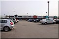
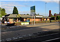
The lifestyle in CW1 1GU is shaped by its proximity to retail, dining, and transport hubs. Nearby amenities include Iceland Crewe, M&S Grand, and Morrisons Daily, offering everyday shopping and convenience for residents. The area’s rail network, with stations at Crewe, Sandbach, and Nantwich, provides easy access to larger towns and cities, enhancing connectivity for work, leisure, and social activities. While the data does not specify parks or leisure facilities within the postcode itself, the surrounding area includes historical sites like Crewe Hall and green spaces such as Rookery Wood and Temple of Peace Wood, which may be accessible to residents. The mix of retail options and transport links supports a practical, community-oriented lifestyle, though those seeking extensive recreational facilities may need to venture slightly beyond the immediate area.
Amenities
Schools
The area is served by three primary schools: Hungerford Primary School and two instances of Hungerford Primary Academy, one of which has an Ofsted rating of ‘satisfactory’. These schools provide early education options for families within the postcode. The presence of multiple primary schools suggests a focus on local education, though no secondary schools are listed in the data. For families, this means children would likely need to travel to nearby towns for secondary education, such as Crewe or Nantwich. The ‘satisfactory’ rating at one academy indicates a moderate standard of education, but without further details on curriculum or performance metrics, it is difficult to assess broader quality. The availability of primary schools supports the area’s appeal to families, though parents should investigate additional educational opportunities beyond the immediate vicinity.
| Rank | School | Type | Entry gender | Ages |
|---|
Explore more schools in this area
Go to Schools tabDemographics
The population of CW1 1GU has a median age of 47, with the majority of residents aged between 30 and 64 years. This suggests a mature, established community, likely with a strong presence of families and long-term residents. Home ownership is high at 69%, indicating a stable housing market and a preference for property as an investment. The accommodation type is predominantly houses, reflecting a suburban or semi-rural character. The predominant ethnic group is White, which aligns with broader demographic trends in the region. The absence of specific data on diversity or deprivation means the area’s social fabric remains largely uncharacterised by significant socio-economic variation. For quality of life, the high home ownership rate and age profile suggest a community focused on long-term residency and family stability, though further data would be needed to assess broader inclusivity or deprivation levels.
Household Size
Accommodation Type
Tenure
Ethnic Group
Religion
Household Composition
Age
Household Deprivation
NS-SEC
Explore more demographic insights in this area
Go to Demographics tabPlanning
Planning Constraints
- Flood RiskPremium
- Ramsar Wetland SitesPremium
- Area of Outstanding Natural BeautyPremium
- Protected Nature ReservePremium
- Protected WoodlandPremium