Area Overview for CW1 4SJ
Photos of CW1 4SJ
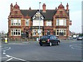


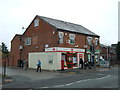


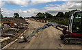


12 photos from this area
Area Information
Key information about the CW1 4SJ including its size, population, and administrative classification.
- Area Type
- Postcode
- Area Size
- 1.2 hectares
- Population
- 1752
- Population Density
- 1636 people/km²
House Prices in CW1 4SJ
55
Properties
£194,890
Average Sold Price
£152,096
Lowest Price
£300,000
Highest Price
Showing 55 properties
| Address | Type | Beds | Baths | Last Sale Price | Last Sale Date | |
|---|---|---|---|---|---|---|
| 67 Samuel Armstrong Way, Crewe, CW1 4SJ | Terraced | 2 | 1 | £175,000 | Oct 2025 | |
| 49 Samuel Armstrong Way, Crewe, CW1 4SJ | Semi-detached | 3 | 2 | £239,000 | Feb 2025 | |
| 59 Samuel Armstrong Way, Crewe, CW1 4SJ | Terraced | 3 | 1 | £180,000 | Dec 2024 | |
| 35 Samuel Armstrong Way, Crewe, CW1 4SJ | Detached | 4 | 3 | £300,000 | Nov 2024 | |
| 71 Samuel Armstrong Way, Crewe, CW1 4SJ | Terraced | 2 | 1 | £168,000 | Oct 2024 | |
| 17 Samuel Armstrong Way, Crewe, CW1 4SJ | Semi-detached | 3 | 1 | £180,000 | Aug 2024 | |
| 69 Samuel Armstrong Way, Crewe, CW1 4SJ | Terraced | 2 | 1 | £157,000 | Apr 2023 | |
| 9 Samuel Armstrong Way, Crewe, CW1 4SJ | Detached | 3 | 1 | £265,000 | Mar 2023 | |
| 5 Samuel Armstrong Way, Crewe, CW1 4SJ | Semi-detached | 3 | 1 | £193,000 | Jul 2022 | |
| 75 Samuel Armstrong Way, Crewe, CW1 4SJ | Retail | 3 | 2 | £203,500 | May 2022 |
Page 1 of 6
Energy Efficiency in CW1 4SJ
Amenities
Schools
| Rank | School | Type | Entry gender | Ages |
|---|
Explore more schools in this area
Go to Schools tabDemographics
Household Size
Family (3-5 people)
most common
Accommodation Type
Houses
most common
Tenure
62
majority
Ethnic Group
White
most common
Religion
N/A
most common
Household Composition
N/A
most common
Age
47
median
Adults (30-64 years)
most common
Household Deprivation
N/A
with no deprivation
NS-SEC
21
in Lower managerial occupations
Explore more demographic insights in this area
Go to Demographics tabPlanning
Planning Constraints
- Flood RiskPremium
- Ramsar Wetland SitesPremium
- Area of Outstanding Natural BeautyPremium
- Protected Nature ReservePremium
- Protected WoodlandPremium