Area Overview for CW1 4SH
Photos of CW1 4SH
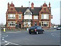


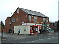


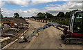


12 photos from this area
Area Information
Key information about the CW1 4SH including its size, population, and administrative classification.
- Area Type
- Postcode
- Area Size
- 2.6 hectares
- Population
- 1752
- Population Density
- 1636 people/km²
House Prices in CW1 4SH
63
Properties
£206,261
Average Sold Price
£146,995
Lowest Price
£335,000
Highest Price
Showing 63 properties
| Address | Type | Beds | Baths | Last Sale Price | Last Sale Date | |
|---|---|---|---|---|---|---|
| 56 Samuel Armstrong Way, Crewe, CW1 4SH | Terraced | 2 | 2 | £170,000 | Mar 2025 | |
| 66 Samuel Armstrong Way, Crewe, CW1 4SH | Semi-detached | 3 | 2 | £236,000 | Jan 2025 | |
| 88 Samuel Armstrong Way, Crewe, CW1 4SH | Detached | 3 | 1 | £188,000 | Apr 2024 | |
| 82 Samuel Armstrong Way, Crewe, CW1 4SH | Semi-detached | 3 | 2 | £223,000 | Sep 2023 | |
| 6 Samuel Armstrong Way, Crewe, CW1 4SH | Semi-detached | 3 | 2 | £195,000 | Aug 2023 | |
| 36 Samuel Armstrong Way, Crewe, CW1 4SH | Semi-detached | 3 | 3 | £244,500 | Mar 2023 | |
| 14 Samuel Armstrong Way, Crewe, CW1 4SH | Detached | 4 | 2 | £335,000 | Oct 2022 | |
| 96 Samuel Armstrong Way, Crewe, CW1 4SH | Retail | 3 | 2 | £195,000 | May 2022 | |
| 16 Samuel Armstrong Way, Crewe, CW1 4SH | house | - | - | £241,000 | Jul 2021 | |
| 84 Samuel Armstrong Way, Crewe, CW1 4SH | house | - | - | £213,995 | Feb 2021 |
Page 1 of 7
Energy Efficiency in CW1 4SH
Amenities
Schools
| Rank | School | Type | Entry gender | Ages |
|---|
Explore more schools in this area
Go to Schools tabDemographics
Household Size
Family (3-5 people)
most common
Accommodation Type
Houses
most common
Tenure
62
majority
Ethnic Group
White
most common
Religion
N/A
most common
Household Composition
N/A
most common
Age
47
median
Adults (30-64 years)
most common
Household Deprivation
N/A
with no deprivation
NS-SEC
21
in Lower managerial occupations
Explore more demographic insights in this area
Go to Demographics tabPlanning
Planning Constraints
- Flood RiskPremium
- Ramsar Wetland SitesPremium
- Area of Outstanding Natural BeautyPremium
- Protected Nature ReservePremium
- Protected WoodlandPremium