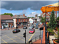
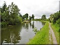
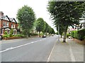
Area Overview for Stockton Heath
Photos of Stockton Heath


Area Information
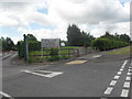
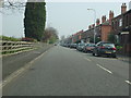
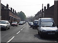
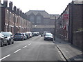
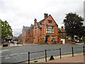
Stockton Heath stands as a distinct civil parish in England, covering a compact footprint of just 1.4 km². Living in Stockton Heath means inhabiting a tightly knit environment where space is at a premium. The area functions as a self-contained community, defined by its small administrative boundaries and established residential character. This intimate scale fosters a neighbourhood feel where residents are often neighbours by default. When you consider homes in Stockton Heath, you are looking at a location that has remained relatively unchanged in its fundamental nature over time. The parish status indicates a level of local governance separate from larger boroughs, allowing for specific management of local affairs. Daily life here involves navigating a small geographic area where distances are short and the setting is familiar. You do not find sprawling developments; instead, you encounter a concentrated settlement pattern typical of older English parishes. The area's identity is rooted in this limited physical size, which shapes the pace of life and the nature of local interactions. Prospective buyers must appreciate that the charm of Stockton Heath comes from its smallness and its clear boundaries as a parish entity within the wider county structure.
- Area Type
- Parish
- Area Size
- 1.4 km²
- Population
- Not available
- Population Density
- Not available
Demographics
The community profile of Stockton Heath reveals an older population, with a median age of 70 years. This figure places the area well above the national average for England, indicating that the area attracts older residents or serves as a retirement destination. When living in Stockton Heath, you join a demographic group where retirement and later-life living dominate the landscape. Home ownership is exceptionally high at 79 per cent, meaning the vast majority of households own their property outright or with a mortgage. This high ownership rate typically signals a settled, long-term resident base rather than a transient population of renters. The household composition across the entire parish reflects this stable demographic structure, although specific breakdowns by family type are not detailed in the available records. Accommodation types similarly follow this pattern of stability, with the total stock reflecting the needs of an older, predominantly owning population. The absence of significant minority ethnic groups or varied religious affiliations in the recorded totals suggests a homogenous community. Deprivation indicators are not explicitly quantified in the current dataset, but the high ownership rates and older age profile often correlate with specific economic dynamics common in established rural parishes. You can expect a quiet, stable society where established families and individuals reside for long periods.
Household Size
Accommodation Type
Tenure
Ethnic Group
Religion
Household Composition
Age
Household Deprivation
NS-SEC
Explore more demographic insights in this area
Go to Demographics tabPlanning
Planning Constraints
- Flood RiskPremium
- Ramsar Wetland SitesPremium
- Area of Outstanding Natural BeautyPremium
- Protected Nature ReservePremium
- Protected WoodlandPremium