Area Overview for Warrington
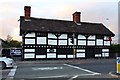
Photos of Warrington


Area Information
Living in Warrington offers a distinct experience within a built-up area defined by its manageable scale and community focus. The locality covers 47.7 square kilometres, providing enough space for residential communities without the density of larger cities. You will find that the population stands at 36,419 people, creating a neighbourhood size that often facilitates a sense of familiarity among residents. This figure indicates a community that is settled and established rather than a rapidly expanding new-build estate. The character of Warrington is rooted in this stable population count, which supports a range of local services without the congestion seen in metropolitan centres. Residents here can expect daily life to revolve around practical accessibility and neighbourhood cohesion. The area functions as a self-contained town where you can address most of your needs locally. When considering homes in Warrington, you are looking at a location where the built environment supports a steady pace of living. The area's identity is formed by its residents and its specific geographic footprint. You will find that the distinction of this locality lies in its balance between urban amenities and a quieter residential setting. This environment suits those who value a home surrounded by a defined community rather than a sprawling conurbation.
- Area Type
- Built Up Area 250
- Area Size
- 47.7 km²
- Population
- 36419
- Population Density
- 763 people/km²
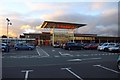
Your daily life in Warrington is supported by a network of practical amenities within easy reach. The retail sector offers five accessible locations where you can shop and grab refreshments. Co-op Orford, Heron Orford, and Farmfoods Warrington serve as the primary retail hubs for groceries and daily essentials. These venues are part of a broader network that includes five rail stations facilitating shorter journeys by train. Warrington Central Railway Station, Warrington Bank Quay Railway Station, and Padgate Railway Station provide direct links to wider transport networks. Residents benefit from a layout that keeps essential services close to their homes without requiring long car journeys. The character of this lifestyle is defined by convenience and accessibility. You can manage your weekly shopping needs at Farmfoods Warrington or the cooperative stores without traveling to the city centre. The presence of these specific named amenities confirms a functional town hub. Dining options and leisure facilities exist within this practical radius. Living in Warrington means you rely on a structured set of local services designed for the existing population. Transport options complement the local shops, ensuring you are not reliant solely on road networks. This balance of rail and retail creates a stable environment for day-to-day activities.
Amenities
Schools
Families living in Warrington have access to a specific selection of educational institutions primarily focused on early years. The nearest nursery, Sandy Lane Nursery and Forest School, provides early education for the youngest residents. This facility serves as a starting point for children before they transition to primary education. There are primary schools nearby that accept pupils from early reception upwards. Beamont Community Junior School and Beamont Community Infant School operate as part of the same community education provision, offering continuous schooling for young learners. Additionally, Alderman Bolton Infant School and Alderman Bolton Junior School provide alternative primary education options within the vicinity. All listed institutions for children over the age of five are primary schools. The data indicates that there are no secondary schools explicitly named in the immediate catchment list provided for this area. This mix of nursery and primary schools suggests that families with school-aged children often reside slightly further out or that secondary options are located in adjacent towns. If you are bringing children to live in Warrington, your main choice will be between Beamont and Alderman Bolton for primary education. You should verify secondary arrangements separately, though the local primary options are well-distributed.
| Rank | School | Type | Entry gender | Ages |
|---|
Explore more schools in this area
Go to Schools tabDemographics
The demographic profile of Warrington reveals a settled community with clear patterns in age and ownership. The median age in the area is 70, indicating a population skewed significantly towards older adults. This high median age suggests that many families with young children may have moved on, leaving behind a cohort with long-standing ties to the neighbourhood. Home ownership stands at 68%, which is a strong indicator of stability within the housing stock. A majority of the population owns their property outright or with a mortgage, implying that residents have been settled for extended periods. This high rate of ownership often correlates with deeper community involvement and a slower turnover of residents. You will find that household compositions likely reflect this older demographic, with a higher proportion of single-person households or couples without children. The data does not specify ethnic groups or religious affiliations, but the demographic weight heavily favours an older population structure. For someone looking at living in Warrington, this means you are entering a market dominated by established residents rather than new families or young professionals. The community feels mature, with a low median age driving a need for healthcare and leisure facilities suitable for seniors rather than youth-focused centres.