Area Overview for CH66 6AH
Photos of CH66 6AH
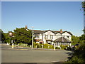
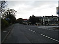
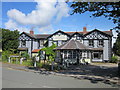


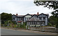

16 photos from this area
Area Information
Key information about the CH66 6AH including its size, population, and administrative classification.
- Area Type
- Postcode
- Area Size
- 3.7 hectares
- Population
- 1399
- Population Density
- 169 people/km²
House Prices in CH66 6AH
17
Properties
£240,756
Average Sold Price
£111,000
Lowest Price
£325,000
Highest Price
Showing 17 properties
| Address | Type | Beds | Baths | Last Sale Price | Last Sale Date | |
|---|---|---|---|---|---|---|
| 16 Hooton Way, Hooton, Ellesmere Port, CH66 6AH | house | - | - | £325,000 | Oct 2020 | |
| 2B Hooton Way, Hooton, Ellesmere Port, CH66 6AH | Detached | 4 | 2 | £288,000 | Feb 2018 | |
| 2A Hooton Way, Hooton, Ellesmere Port, CH66 6AH | Detached | 4 | 2 | £292,050 | Sep 2017 | |
| 22 Hooton Way, Hooton, Ellesmere Port, CH66 6AH | Semi-detached | 3 | - | £265,000 | Oct 2016 | |
| 20 Hooton Way, Hooton, Ellesmere Port, CH66 6AH | Semi-detached | - | - | £230,000 | Jun 2007 | |
| 8 Hooton Way, Hooton, Ellesmere Port, CH66 6AH | Semi-detached | - | - | £215,000 | Sep 2006 | |
| 24 Hooton Way, Hooton, Ellesmere Port, CH66 6AH | Detached | - | - | £200,000 | Aug 2003 | |
| 10 Hooton Way, Hooton, Ellesmere Port, CH66 6AH | Semi-detached | - | - | £111,000 | Jul 2001 | |
| 2 Hooton Way, Hooton, Ellesmere Port, CH66 6AH | Detached | 4 | 2 | - | - | |
| April Rise, 2C Hooton Way, Hooton, Ellesmere Port, CH66 6AH | Detached | 4 | - | - | - |
Page 1 of 2
Energy Efficiency in CH66 6AH
Amenities
Schools
| Rank | School | Type | Entry gender | Ages |
|---|
Explore more schools in this area
Go to Schools tabDemographics
Household Size
Two person
most common
Accommodation Type
Houses
most common
Tenure
82
majority
Ethnic Group
White
most common
Religion
N/A
most common
Household Composition
N/A
most common
Age
47
median
Adults (30-64 years)
most common
Household Deprivation
N/A
with no deprivation
NS-SEC
48
in Lower managerial occupations
Explore more demographic insights in this area
Go to Demographics tabPlanning
Planning Constraints
- Flood RiskPremium
- Ramsar Wetland SitesPremium
- Area of Outstanding Natural BeautyPremium
- Protected Nature ReservePremium
- Protected WoodlandPremium