Area Overview for CH66 1QU
Photos of CH66 1QU
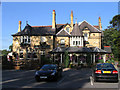
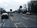
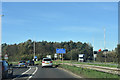
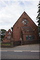
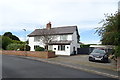
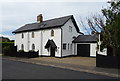
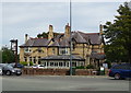
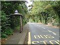


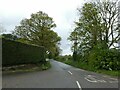
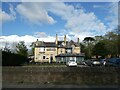
18 photos from this area
Area Information
Key information about the CH66 1QU including its size, population, and administrative classification.
- Area Type
- Postcode
- Area Size
- 11.1 hectares
- Population
- 1399
- Population Density
- 169 people/km²
House Prices in CH66 1QU
23
Properties
£328,500
Average Sold Price
£167,500
Lowest Price
£560,000
Highest Price
Showing 23 properties
| Address | Type | Beds | Baths | Last Sale Price | Last Sale Date | |
|---|---|---|---|---|---|---|
| Hooton Farm West, Hooton Road, Hooton, Ellesmere Port, CH66 1QU | house | 5 | 2 | £230,000 | Sep 2024 | |
| The Oak House, Hooton Road, Hooton, Ellesmere Port, CH66 1QU | Land | - | - | £300,000 | May 2020 | |
| 7, Chestnut Farm, Hooton Road, Hooton, Ellesmere Port, CH66 1QU | Terraced | 4 | 2 | £385,000 | Jan 2018 | |
| Hooton Chase, Hooton Road, Hooton, Ellesmere Port, CH66 1QU | Retail | 4 | - | £560,000 | Jan 2007 | |
| The Coach House, Hooton Road, Hooton, Ellesmere Port, CH66 1QU | Semi-detached | 4 | 2 | £167,500 | Jun 2000 | |
| 2, Chestnut Farm, Hooton Road, Hooton, Ellesmere Port, CH66 1QU | Semi-detached | 3 | 2 | - | - | |
| 3, Chestnut Farm, Hooton Road, Hooton, Ellesmere Port, CH66 1QU | Bungalow | 2 | 2 | - | - | |
| 12, The Old Blacksmiths Shop, Chestnut Farm, Hooton Road, Hooton, Ellesmere Port, CH66 1QU | Semi-detached | 3 | 3 | - | - | |
| 8, Chestnut Farm, Hooton Road, Hooton, Ellesmere Port, CH66 1QU | Semi-detached | 4 | 3 | - | - | |
| 10, Chestnut Barn, Chestnut Farm, Hooton Road, Hooton, Ellesmere Port, CH66 1QU | Bungalow | 2 | 1 | - | - |
Page 1 of 3
Energy Efficiency in CH66 1QU
Amenities
Schools
| Rank | School | Type | Entry gender | Ages |
|---|
Explore more schools in this area
Go to Schools tabDemographics
Household Size
Two person
most common
Accommodation Type
Houses
most common
Tenure
82
majority
Ethnic Group
White
most common
Religion
N/A
most common
Household Composition
N/A
most common
Age
47
median
Adults (30-64 years)
most common
Household Deprivation
N/A
with no deprivation
NS-SEC
48
in Lower managerial occupations
Explore more demographic insights in this area
Go to Demographics tabPlanning
Planning Constraints
- Flood RiskPremium
- Ramsar Wetland SitesPremium
- Area of Outstanding Natural BeautyPremium
- Protected Nature ReservePremium
- Protected WoodlandPremium