Area Overview for CH65 4EB
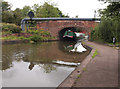
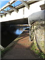
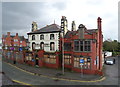
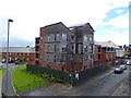
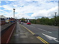
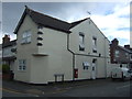
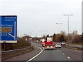
Photos of CH65 4EB

Area Information
Westminster Ward is a small residential cluster located in Ellesmere Port, Cheshire, North West England. This specific postcode area, covering CH65 4EB, occupies just 2,508 square metres and serves a population of 1,246 people. The locale is situated near coordinates 53.285654, -2.89948, placing it within the unitary authority of Cheshire West and Chester. Residents here live in close proximity to landmarks such as Westminster Grove, which falls within the broader CH65 2DU cluster. The area functions as a compact neighbourhood where daily life revolves around the immediate streets and the wider town of Ellesmere Port. With a population density of 280 people per square kilometre, the ward offers a tightly knit environment rather than a sprawling suburb. You will find that living in CH65 4EB means navigating a designated electoral ward that encompasses specific clusters of homes. The small footprint of the area suggests a community where neighbours are likely to know one another. The location provides a gateway to the larger amenities of the town while maintaining a distinct residential identity. This postcode serves as a specific gateway into the wider Westminster Ward community.
- Area Type
- Postcode
- Area Size
- 2508 m²
- Population
- 1246
- Population Density
- 280 people/km²
The housing stock in CH65 4EB is characterised primarily by houses rather than apartments or purpose-built developments. With 36% of the area classified as owner-occupied, you will find a significant number of families and individuals who have chosen to buy into the local market. The remaining 64% of the residential units are let to tenants. This split indicates a mix of ownership and rental properties that caters to different financial situations. When searching for homes in CH65 4EB, your options will centre on detached, semi-detached, or terraced houses. The small total population of 1,246 suggests a limited supply of properties available for immediate purchase. You will need to look carefully at the local listings, as the sheer number of homes within this 2,508 square metre area is restricted. The area's status as a specific residential cluster implies that investment opportunities are niche. Buyers focused on finding a house in this location should prepare for a competitive market driven by the lack of large-scale building projects. The prevalence of houses matches the majority adult age range, suggesting families and couples form the core of the buyer pool.
House Prices in CH65 4EB
Showing 11 properties
| Address | Type | Beds | Baths | Last Sale Price | Last Sale Date | |
|---|---|---|---|---|---|---|
| 6 Companion Street, Ellesmere Port, CH65 4EB | house | - | - | - | - | |
| 5 Companion Street, Ellesmere Port, CH65 4EB | house | - | - | - | - | |
| 2 Companion Street, Ellesmere Port, CH65 4EB | house | - | - | - | - | |
| 3 Companion Street, Ellesmere Port, CH65 4EB | house | - | - | - | - | |
| 4 Companion Street, Ellesmere Port, CH65 4EB | house | - | - | - | - | |
| 11 Companion Street, Ellesmere Port, CH65 4EB | house | - | - | - | - | |
| 13 Companion Street, Ellesmere Port, CH65 4EB | house | - | - | - | - | |
| 8 Companion Street, Ellesmere Port, CH65 4EB | house | - | - | - | - | |
| 1 Companion Street, Ellesmere Port, CH65 4EB | house | - | - | - | - | |
| 7 Companion Street, Ellesmere Port, CH65 4EB | house | - | - | - | - |
Energy Efficiency in CH65 4EB
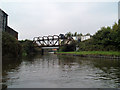
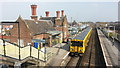
Daily life in CH65 4EB benefits from proximity to several key amenities within practical reach. You can shop at Morrisons Daily, Aldi Ellesmere, and Farmfoods Ellesmere, which are located in the nearby retail cluster. These five retail outlets ensure you have access to groceries and everyday essentials without travelling far. Transport links are supported by five railway stations nearby, including Ellesmere Port Railway Station, Overpool Railway Station, and Stanlow and Thornton Railway Station. These rail hubs provide convenient travel options for commuting to larger cities or visiting other parts of the country. Two airports serve the region, with Liverpool John Lennon Airport being the nearest major aviation link. This connectivity allows you to travel abroad or reach major business centres efficiently. The presence of these transport nodes makes living in CH65 4EB attractive for those who value access to wider networks. Your regular shopping trips and weekly commute will be streamlined by the location of the railway stations and supermarkets.
Amenities
Schools
| Rank | School | Type | Entry gender | Ages |
|---|
Explore more schools in this area
Go to Schools tabDemographics
The community in this postcode area reflects a mature demographic with a median age of 47 years. The majority of the population consists of adults aged between 30 and 64 years. This age profile indicates that your neighbours are likely to be established families or individuals seeking stability in their housing. Home ownership stands at 36%, meaning the remaining 64% of households are rented privately or socially. This high proportion of tenants suggests a dynamic rental market operating alongside the owner-occupied stock. Houses dominate the accommodation type, confirming that you will almost certainly find standalone properties rather than blocks of flats. The predominant ethnic group is White, which aligns with the broader demographic trends of North West England. You can expect a relatively homogenous community driven by the specific needs of the adult population. The low density of 280 people per square kilometre supports a quiet residential atmosphere. These demographic facts define who resides here and shape the daily interactions within the ward.
Household Size
Accommodation Type
Tenure
Ethnic Group
Religion
Household Composition
Age
Household Deprivation
NS-SEC
Explore more demographic insights in this area
Go to Demographics tabPlanning
Planning Constraints
- Flood RiskPremium
- Ramsar Wetland SitesPremium
- Area of Outstanding Natural BeautyPremium
- Protected Nature ReservePremium
- Protected WoodlandPremium