Area Overview for CH65 4EU
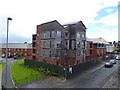
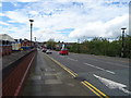
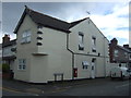
Photos of CH65 4EU


Area Information
Living in CH65 4EU means being part of a small, tightly knit residential cluster in Cheshire’s Ellesmere Port area. With a population of 1,246 and a density of 280 people per square kilometre, the area is compact yet functional, catering to a community that values proximity to essential services. The postcode sits within Westminster Ward, an electoral area known for its mix of local amenities and commuter links. Daily life here is shaped by its modest size and the surrounding infrastructure. Residents benefit from nearby rail connections and retail hubs, while the area’s low flood risk and absence of protected natural sites suggest a practical, low-constraint environment. Though small, CH65 4EU is positioned to serve both local needs and regional travel, with its coordinates placing it near key transport arteries. For those seeking a quiet, manageable community with accessible amenities, this postcode offers a blend of simplicity and connectivity.
- Area Type
- Postcode
- Area Size
- Not available
- Population
- 1246
- Population Density
- 280 people/km²
The property market in CH65 4EU is defined by its low home ownership rate of 36%, which implies that the majority of properties are rented rather than owner-occupied. This suggests a rental market that may cater to both long-term tenants and those seeking temporary accommodation. The accommodation type is primarily houses, which is notable in a small postcode area, indicating a focus on family-sized homes rather than apartments or flats. For buyers, this means limited availability of properties for purchase, with most options being owner-occupied homes. The small size of the area also means that the immediate surroundings are critical for property searches, as the local housing stock is constrained. Prospective buyers should consider the competitive nature of the market and the potential for higher demand in a limited supply, particularly for homes that align with the area’s preference for standalone properties.
House Prices in CH65 4EU
No properties found in this postcode.
Energy Efficiency in CH65 4EU
Residents of CH65 4EU have access to a range of amenities within practical reach, enhancing daily life. The area’s retail options include Morrisons Daily, Aldi Ellesmere, and Farmfoods Ellesmere, providing a variety of shopping choices for groceries and household items. Rail stations like Ellesmere Port and Stanlow & Thornton offer easy access to commuting routes, while the proximity to Liverpool John Lennon Airport ensures convenient travel for those needing regional or international connections. Though the data does not mention parks or leisure facilities, the presence of multiple rail and retail points suggests a community-oriented environment. The small size of the area means that amenities are close, reducing the need for long commutes. For those prioritising convenience, the combination of retail, transport, and nearby airports creates a lifestyle that balances practicality with accessibility, making CH65 4EU a viable choice for those seeking a manageable, service-rich environment.
Amenities
Schools
| Rank | School | Type | Entry gender | Ages |
|---|
Explore more schools in this area
Go to Schools tabDemographics
The community in CH65 4EU is predominantly middle-aged, with a median age of 47 and the majority of residents falling within the 30-64 age range. This suggests a stable, established population, likely with families or long-term residents. Home ownership is relatively low at 36%, indicating that a significant portion of the housing stock is rented. The area is characterised by houses rather than flats, reflecting a preference for standalone properties. The predominant ethnic group is White, though no specific data on other demographics is provided. The age profile and home ownership figures suggest a community that may be more inclined to rent than own, possibly due to economic factors or lifestyle choices. With no mention of deprivation levels, the focus remains on the practical aspects of living here: a mature population, a mix of renters and homeowners, and a housing stock that prioritises single-family homes.
Household Size
Accommodation Type
Tenure
Ethnic Group
Religion
Household Composition
Age
Household Deprivation
NS-SEC
Explore more demographic insights in this area
Go to Demographics tabPlanning
Planning Constraints
- Flood RiskPremium
- Ramsar Wetland SitesPremium
- Area of Outstanding Natural BeautyPremium
- Protected Nature ReservePremium
- Protected WoodlandPremium