Area Overview for CH64 3TH
Photos of CH64 3TH
Area Information
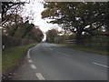
Living in CH64 3TH means being part of a small, tightly knit residential cluster in England, nestled within a 15.9-hectare area that accommodates 2,046 residents. The postcode covers a quiet, low-density environment with a population density of 202 people per square kilometre, offering a balance between rural tranquillity and proximity to nearby towns. This area is part of Neston, a historic market town with Viking-era roots and a long-standing reputation as a commercial hub. Daily life here is shaped by its heritage, with a focus on community and tradition. The presence of nearby rail stations, retail outlets, and a ferry terminal ensures practical connectivity without compromising the peaceful character of the surroundings. With a median age of 47 and a strong elderly population, the area reflects a mature demographic, where many residents have lived for decades. The high home ownership rate (87%) and prevalence of houses suggest a stable, family-oriented environment. For those seeking a blend of history, safety, and convenience, CH64 3TH offers a distinctive slice of Cheshire’s quieter countryside.
- Area Type
- Postcode
- Area Size
- 15.9 hectares
- Population
- 2046
- Population Density
- 202 people/km²
The property market in CH64 3TH is dominated by owner-occupied homes, with 87% of properties owned outright. This high home ownership rate, combined with the prevalence of houses, indicates a market that caters to long-term residents rather than renters. The small area size (15.9 hectares) and limited population suggest a constrained housing stock, likely centred on traditional family homes. Buyers should expect a focus on established properties with little new development, making the area appealing to those seeking stability and a sense of community. The absence of rental properties implies that the market is not geared towards short-term tenancies, which may limit options for those requiring flexibility. For buyers, this means a potential opportunity to invest in a property within a close-knit, low-risk environment, though competition for available homes could be fierce given the area’s small size and appeal.
House Prices in CH64 3TH
Showing 17 properties
| Address | Type | Beds | Baths | Last Sale Price | Last Sale Date | |
|---|---|---|---|---|---|---|
| Lyndale Farm House, Chester High Road, Neston, CH64 3TH | house | 4 | 1 | £607,000 | Oct 2024 | |
| Mapleoak Cattery, Chester High Road, Neston, CH64 3TH | Detached | - | - | £350,000 | Mar 2023 | |
| Dunvegan, Chester High Road, Neston, CH64 3TH | Bungalow | 4 | - | £570,000 | Jul 2022 | |
| Eldon, Chester High Road, Neston, CH64 3TH | house | - | - | £425,000 | Apr 2021 | |
| Cherrydale, Chester High Road, Neston, CH64 3TH | Bungalow | 3 | - | £390,000 | Dec 2017 | |
| Widmuth, Chester High Road, Neston, CH64 3TH | house | 3 | - | £288,000 | Feb 2013 | |
| Cedar View, Chester High Road, Neston, CH64 3TH | Detached | 5 | - | £225,000 | Jul 2010 | |
| Redstacks, Chester High Road, Neston, CH64 3TH | Detached | - | - | £250,000 | Mar 2002 | |
| Malincourt, Chester High Road, Neston, CH64 3TH | Detached | 4 | - | £128,000 | Sep 1997 | |
| Longfield, Chester High Road, Neston, CH64 3TH | Detached | 5 | - | - | - |
Energy Efficiency in CH64 3TH
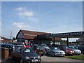
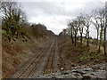
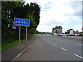
Residents of CH64 3TH have access to a range of practical amenities within easy reach. Five rail stations, including Heswall and Neston, offer convenient links to nearby towns and cities, while retail options such as M&S Heswall and Aldi Neston provide everyday shopping needs. A ferry terminal at Woodside Birkenhead adds versatility for travel and commuting. The area’s historical character, rooted in Neston’s market town heritage, complements its modern conveniences. The presence of a Friday market and monthly Farmer’s Market in Neston ensures a vibrant local economy, while the town’s historic buildings and Viking-era landmarks contribute to a distinct cultural atmosphere. For daily life, the combination of retail, transport, and heritage creates a balanced lifestyle, blending practicality with a sense of place. The low population density and proximity to amenities make it ideal for those seeking a relaxed yet connected existence.
Amenities
Schools
| Rank | School | Type | Entry gender | Ages |
|---|
Explore more schools in this area
Go to Schools tabDemographics
The community in CH64 3TH is predominantly elderly, with 65+ years being the most common age range and a median age of 47. This suggests a mature population, likely with long-term residents who have established roots in the area. Home ownership is exceptionally high at 87%, indicating a strong sense of stability and investment in property. The accommodation type is primarily houses, reflecting a residential character that prioritises private, family-oriented living over flats or apartments. The predominant ethnic group is White, with no specific data on diversity or minority representation. The low population density (202 people/km²) and high home ownership suggest a community focused on comfort and long-term residency rather than transient populations. While no deprivation data is provided, the combination of high ownership and stable demographics implies a quality of life that prioritises security and continuity for residents.
Household Size
Accommodation Type
Tenure
Ethnic Group
Religion
Household Composition
Age
Household Deprivation
NS-SEC
Explore more demographic insights in this area
Go to Demographics tabPlanning
Planning Constraints
- Flood RiskPremium
- Ramsar Wetland SitesPremium
- Area of Outstanding Natural BeautyPremium
- Protected Nature ReservePremium
- Protected WoodlandPremium