Area Overview for CH64 3TB
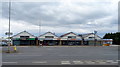
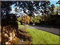
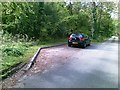
Photos of CH64 3TB
Area Information
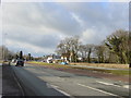
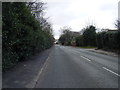
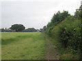
CH64 3TB is a small, tightly knit residential postcode area in England, covering 9.8 hectares and home to 2,046 residents. With a population density of 202 people per square kilometre, it reflects a compact, community-focused environment. Nestled in the Cheshire countryside, the area benefits from its proximity to Neston, a historic market town with Viking-era roots. The town’s tranquil setting contrasts with its past as a bustling port, now replaced by a quieter, rural charm. Daily life here is characterised by a mix of historic architecture and modern convenience. The area’s proximity to rail links, including Heswall and Bromborough stations, offers easy access to nearby towns and cities. Locals enjoy a low crime rate, with a safety score of 88/100, and minimal environmental risks such as flooding. The community is predominantly elderly, with a median age of 47, and 87% of homes are owner-occupied. This blend of heritage, safety, and accessibility makes CH64 3TB a distinctive choice for those seeking a stable, low-maintenance lifestyle.
- Area Type
- Postcode
- Area Size
- 9.8 hectares
- Population
- 2046
- Population Density
- 202 people/km²
CH64 3TB is primarily an owner-occupied area, with 87% of homes owned by residents rather than rented out. The accommodation type is predominantly houses, which is typical for smaller, rural postcode areas. This suggests a housing stock that is largely traditional, with a focus on single-family homes rather than apartments or flats. The limited size of the area—just 9.8 hectares—means the property market is constrained, with few new developments likely to arise. Buyers should expect a stable market with limited competition, as the area is not a hotspot for investment or rental properties. The high home ownership rate indicates that properties are likely to be well-maintained and held long-term, which can be a positive for buyers seeking security and value retention. However, the small size of the area means that prospective buyers must consider nearby towns like Neston for broader property options.
House Prices in CH64 3TB
Showing 6 properties
| Address | Type | Beds | Baths | Last Sale Price | Last Sale Date | |
|---|---|---|---|---|---|---|
| Baregg, Boathouse Lane, Gayton, CH64 3TB | Bungalow | - | - | £352,500 | Aug 2016 | |
| Elmcroft, Boathouse Lane, Parkgate, Neston, CH64 3TB | Land | - | - | £225,000 | Dec 1996 | |
| Derwyn, Boathouse Lane, Gayton, CH64 3TB | Bungalow | 3 | 2 | - | - | |
| Annexe To, Elmcroft, Boathouse Lane, Parkgate, Neston, CH64 3TB | Semi-detached | - | - | - | - | |
| Hafod, Boathouse Lane, Gayton, CH64 3TB | Detached | - | - | - | - | |
| Freshways, Boathouse Lane, Gayton, CH64 3TB | Detached | - | - | - | - |
Energy Efficiency in CH64 3TB
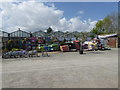
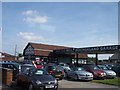
Living in CH64 3TB offers access to a range of local amenities within practical reach. The area is served by five retail outlets, including M&S Heswall, Aldi Gayton, and Cook Heswall, providing everyday shopping convenience. The presence of multiple railway stations—Heswall, Neston, and Bromborough—ensures easy access to broader transport networks, connecting residents to nearby towns and cities. While the data does not explicitly mention parks or leisure facilities, the historic market town of Neston, nearby, retains its market town heritage with a Friday market and monthly Farmer’s Market, suggesting a community-focused lifestyle. The area’s low population density and compact size contribute to a quieter, more private environment, ideal for those seeking a balance between accessibility and tranquillity.
Amenities
Schools
| Rank | School | Type | Entry gender | Ages |
|---|
Explore more schools in this area
Go to Schools tabDemographics
The population of CH64 3TB is 2,046, with a median age of 47 and the most common age range being those aged 65 and over. This suggests a community skewed towards older residents, which influences the area’s character and local amenities. Home ownership is high, with 87% of residents living in their own homes, indicating a stable, long-term population. The accommodation type is predominantly houses, reflecting a traditional, family-oriented housing stock. The predominant ethnic group is White, which aligns with broader demographic trends in the region. The population density of 202 people per square kilometre suggests a low-density, spread-out settlement pattern, contributing to a quieter, more private living environment. This demographic profile means the area is less likely to experience the pressures of high population growth or transient populations, offering a consistent, community-focused atmosphere.
Household Size
Accommodation Type
Tenure
Ethnic Group
Religion
Household Composition
Age
Household Deprivation
NS-SEC
Explore more demographic insights in this area
Go to Demographics tabPlanning
Planning Constraints
- Flood RiskPremium
- Ramsar Wetland SitesPremium
- Area of Outstanding Natural BeautyPremium
- Protected Nature ReservePremium
- Protected WoodlandPremium