Area Overview for CH64 1RG
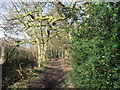
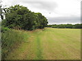
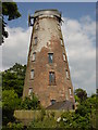
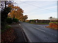
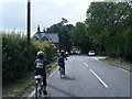
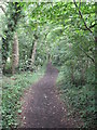
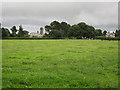
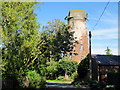
Photos of CH64 1RG
Area Information
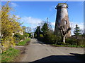
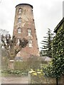
Living in CH64 1RG means being part of a tightly knit residential cluster in the Wirral Peninsula, within Cheshire East. The area covers 7.1 hectares and is home to 1,315 residents, creating a dense but manageable community. Historically part of Neston, this postcode area now forms the Willaston & Thornton Ward, encompassing the village of Willaston and Thornton Hough. The landscape has evolved from medieval farmland to a modern residential hub, with pockets of preserved heritage like the restored K6 telephone box on Wistaston Road. Daily life here balances proximity to urban amenities with a village feel, supported by nearby rail links and a focus on homeownership. The area’s compact size means residents are close to essential services, while its low crime rate and minimal environmental constraints make it a practical choice for those seeking stability. CH64 1RG is not a sprawling suburb but a defined community where local traditions and modern conveniences coexist.
- Area Type
- Postcode
- Area Size
- 7.1 hectares
- Population
- 1315
- Population Density
- 421 people/km²
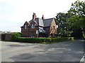
CH64 1RG is predominantly an owner-occupied area, with 94% of homes owned by their residents. The accommodation type is exclusively houses, reflecting a lack of flats or apartments in this small postcode cluster. This suggests a housing stock tailored to families and individuals seeking single-family homes. Given the area’s compact size (7.1 hectares) and population density of 421/km², the property market is likely limited in scope, with limited scope for new developments. Buyers should consider that the area is not a rental hotspot but a place where long-term residents have established roots. The high home ownership rate indicates a stable market, but the small size of the area means that property availability may be constrained. Those seeking a home here would benefit from early engagement with local agents, as the limited supply could lead to competitive bidding.
House Prices in CH64 1RG
Showing 11 properties
| Address | Type | Beds | Baths | Last Sale Price | Last Sale Date | |
|---|---|---|---|---|---|---|
| The Gables, Mill Lane, Willaston, Neston, CH64 1RG | house | - | - | £1,300,000 | Nov 2022 | |
| Goss Moor, Mill Lane, Willaston, Neston, CH64 1RG | Detached | 6 | 3 | £965,000 | Jul 2021 | |
| Millway, Mill Lane, Willaston, Neston, CH64 1RG | Bungalow | 4 | 2 | £718,000 | Feb 2021 | |
| 3, Meadow View, Mill Lane, Willaston, Neston, CH64 1RG | house | - | - | £895,000 | Nov 2019 | |
| 2, Meadow View, Mill Lane, Willaston, Neston, CH64 1RG | house | - | - | £850,000 | May 2019 | |
| Brathay, Mill Lane, Willaston, Neston, CH64 1RG | house | - | - | £805,000 | Sep 2016 | |
| Badger Butts, Mill Lane, Willaston, Neston, CH64 1RG | Detached | - | - | £450,000 | Nov 1999 | |
| 1, Meadow View, Mill Lane, Willaston, Neston, CH64 1RG | Detached | 5 | 4 | - | - | |
| The Pines, Mill Lane, Willaston, Neston, CH64 1RG | Detached | - | - | - | - | |
| Tenleys, Mill Lane, Willaston, Neston, CH64 1RG | house | - | - | - | - |
Energy Efficiency in CH64 1RG
Residents of CH64 1RG have access to a range of amenities within practical reach. The retail options include Spar, Morrisons Eastham, and Tesco Eastham, providing essential shopping and dining choices. The area’s rail network, with stations such as Hooton and Bromborough, ensures easy travel to nearby towns and cities. Locally, Willaston Primary School serves the community, supported by a playgroup for younger children. The village also features recreational spaces like the Lettie Spencer playing field, Mike Heywood Green, and allotments on Crewe Road, offering opportunities for outdoor activity. The restored K6 telephone box, now a book exchange, adds a touch of local charm. While the area is small, its amenities are functional and well-suited to daily life, blending practicality with a sense of community.
Amenities
Schools
| Rank | School | Type | Entry gender | Ages |
|---|
Explore more schools in this area
Go to Schools tabDemographics
The population of CH64 1RG is 1,315, with a median age of 47 and 94% of residents owning their homes. The majority of the population falls within the 30-64 age range, reflecting a mature, established community. Accommodation is predominantly houses, aligning with the high home ownership rate. The predominant ethnic group is White, though specific data on diversity is not provided. With a population density of 421 people per square kilometre, the area is neither sparse nor overcrowded. This density, combined with the high proportion of owner-occupied homes, suggests a stable, long-term resident base. The age profile indicates a community with a strong presence of middle-aged adults, likely with families, contributing to a steady demand for local schools and amenities. The absence of significant deprivation data implies a relatively high standard of living, though this remains unquantified in the provided information.
Household Size
Accommodation Type
Tenure
Ethnic Group
Religion
Household Composition
Age
Household Deprivation
NS-SEC
Explore more demographic insights in this area
Go to Demographics tabPlanning
Planning Constraints
- Flood RiskPremium
- Ramsar Wetland SitesPremium
- Area of Outstanding Natural BeautyPremium
- Protected Nature ReservePremium
- Protected WoodlandPremium