Area Overview for CH64 1SB
Photos of CH64 1SB
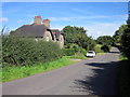
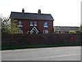

11 photos from this area
Area Information
Key information about the CH64 1SB including its size, population, and administrative classification.
- Area Type
- Postcode
- Area Size
- 1.1 km²
- Population
- 1300
- Population Density
- 67 people/km²
House Prices in CH64 1SB
18
Properties
£466,000
Average Sold Price
£149,000
Lowest Price
£820,000
Highest Price
Showing 18 properties
| Address | Type | Beds | Baths | Last Sale Price | Last Sale Date | |
|---|---|---|---|---|---|---|
| Hargrave, Benty Heath Lane, Willaston, Neston, CH64 1SB | house | - | - | £820,000 | Feb 2025 | |
| The Old Workshop, Benty Heath Lane, Raby, CH64 1SB | house | - | - | £500,000 | Dec 2021 | |
| Gypsy Corner, Benty Heath Lane, Raby, CH64 1SB | Detached | 5 | 2 | £595,000 | Feb 2017 | |
| Skerries, Benty Heath Lane, Willaston, Neston, CH64 1SB | Detached | 4 | - | £403,000 | Nov 2013 | |
| Gorse Hey, Benty Heath Lane, Willaston, Neston, CH64 1SB | house | - | - | £600,000 | Oct 2013 | |
| Fairfield, Benty Heath Lane, Willaston, Neston, CH64 1SB | Detached | - | - | £149,000 | Oct 1998 | |
| Oak Cottage, Benty Heath Lane, Willaston, Neston, CH64 1SB | Detached | - | - | £195,000 | Sep 1998 | |
| Raby House, Benty Heath Lane, Raby, CH64 1SB | Detached | 8 | - | - | - | |
| Raby Nurseries Cottage, Benty Heath Lane, Raby, CH64 1SB | house | - | - | - | - | |
| Raby House Farm Cottage, Benty Heath Lane, Raby, CH64 1SB | Detached | - | - | - | - |
Page 1 of 2
Energy Efficiency in CH64 1SB
Amenities
Schools
| Rank | School | Type | Entry gender | Ages |
|---|
Explore more schools in this area
Go to Schools tabDemographics
Household Size
Two person
most common
Accommodation Type
Houses
most common
Tenure
73
majority
Ethnic Group
White
most common
Religion
N/A
most common
Household Composition
N/A
most common
Age
47
median
Adults (30-64 years)
most common
Household Deprivation
N/A
with no deprivation
NS-SEC
43
in Lower managerial occupations
Explore more demographic insights in this area
Go to Demographics tabPlanning
Planning Constraints
- Flood RiskPremium
- Ramsar Wetland SitesPremium
- Area of Outstanding Natural BeautyPremium
- Protected Nature ReservePremium
- Protected WoodlandPremium