Area Overview for CH61 9PX
Photos of CH61 9PX

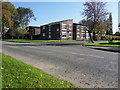
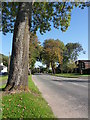
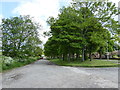
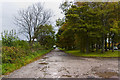
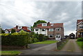

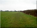
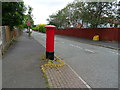
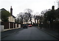
13 photos from this area
Area Information
Key information about the CH61 9PX including its size, population, and administrative classification.
- Area Type
- Postcode
- Area Size
- 9071 m²
- Population
- 1450
- Population Density
- 2534 people/km²
House Prices in CH61 9PX
22
Properties
£133,364
Average Sold Price
£21,000
Lowest Price
£185,000
Highest Price
Showing 22 properties
| Address | Type | Beds | Baths | Last Sale Price | Last Sale Date | |
|---|---|---|---|---|---|---|
| 25 Kings Drive, Irby, CH61 9PX | Semi-detached | 3 | 1 | £185,000 | Feb 2024 | |
| 33 Kings Drive, Irby, CH61 9PX | house | - | - | £170,000 | Apr 2022 | |
| 41 Kings Drive, Irby, CH61 9PX | house | - | - | £170,000 | Mar 2021 | |
| 1 Kings Drive, Irby, CH61 9PX | house | - | - | £180,000 | Jan 2020 | |
| 13 Kings Drive, Irby, CH61 9PX | Semi-detached | 3 | 1 | £154,000 | Apr 2017 | |
| 19 Kings Drive, Irby, CH61 9PX | house | - | - | £157,000 | Mar 2017 | |
| 23 Kings Drive, Irby, CH61 9PX | house | - | - | £140,000 | Jul 2015 | |
| 29 Kings Drive, Irby, CH61 9PX | house | - | - | £115,000 | Dec 2012 | |
| 15 Kings Drive, Irby, CH61 9PX | house | - | - | £118,000 | Feb 2011 | |
| 37 Kings Drive, Irby, CH61 9PX | house | - | - | £21,000 | Jul 2002 |
Page 1 of 3
Energy Efficiency in CH61 9PX
Amenities
Schools
| Rank | School | Type | Entry gender | Ages |
|---|
Explore more schools in this area
Go to Schools tabDemographics
Household Size
Two person
most common
Accommodation Type
Houses
most common
Tenure
78
majority
Ethnic Group
White
most common
Religion
N/A
most common
Household Composition
N/A
most common
Age
47
median
Adults (30-64 years)
most common
Household Deprivation
N/A
with no deprivation
NS-SEC
37
in Lower managerial occupations
Explore more demographic insights in this area
Go to Demographics tabPlanning
Planning Constraints
- Flood RiskPremium
- Ramsar Wetland SitesPremium
- Area of Outstanding Natural BeautyPremium
- Protected Nature ReservePremium
- Protected WoodlandPremium