Area Overview for CH61 3XT
Photos of CH61 3XT

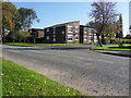
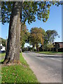
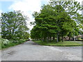
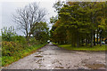
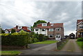

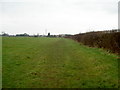
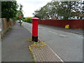
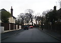
13 photos from this area
Area Information
Key information about the CH61 3XT including its size, population, and administrative classification.
- Area Type
- Postcode
- Area Size
- 1.6 hectares
- Population
- 1450
- Population Density
- 2534 people/km²
House Prices in CH61 3XT
29
Properties
£163,403
Average Sold Price
£47,000
Lowest Price
£300,000
Highest Price
Showing 29 properties
| Address | Type | Beds | Baths | Last Sale Price | Last Sale Date | |
|---|---|---|---|---|---|---|
| 49 Marlston Avenue, Irby, CH61 3XT | Detached | 4 | 2 | £300,000 | Sep 2025 | |
| 33 Marlston Avenue, Irby, CH61 3XT | house | 3 | 1 | £230,000 | Jul 2025 | |
| 43 Marlston Avenue, Irby, CH61 3XT | house | - | - | £182,500 | May 2022 | |
| 29 Marlston Avenue, Irby, CH61 3XT | Semi-detached | 3 | 1 | £210,000 | Jan 2022 | |
| 39 Marlston Avenue, Irby, CH61 3XT | house | - | - | £212,000 | Dec 2021 | |
| 55 Marlston Avenue, Irby, CH61 3XT | house | - | - | £187,000 | Aug 2021 | |
| 31 Marlston Avenue, Irby, CH61 3XT | Semi-detached | 3 | - | £198,000 | Aug 2021 | |
| 19 Marlston Avenue, Irby, CH61 3XT | Semi-detached | 2 | 1 | £150,000 | Mar 2019 | |
| 53 Marlston Avenue, Irby, CH61 3XT | Semi-detached | 3 | - | £160,000 | Sep 2018 | |
| 25 Marlston Avenue, Irby, CH61 3XT | Detached | 3 | 1 | £180,000 | Apr 2018 |
Page 1 of 3
Energy Efficiency in CH61 3XT
Amenities
Schools
| Rank | School | Type | Entry gender | Ages |
|---|
Explore more schools in this area
Go to Schools tabDemographics
Household Size
Two person
most common
Accommodation Type
Houses
most common
Tenure
78
majority
Ethnic Group
White
most common
Religion
N/A
most common
Household Composition
N/A
most common
Age
47
median
Adults (30-64 years)
most common
Household Deprivation
N/A
with no deprivation
NS-SEC
37
in Lower managerial occupations
Explore more demographic insights in this area
Go to Demographics tabPlanning
Planning Constraints
- Flood RiskPremium
- Ramsar Wetland SitesPremium
- Area of Outstanding Natural BeautyPremium
- Protected Nature ReservePremium
- Protected WoodlandPremium