Area Overview for CH61 2XS
Photos of CH61 2XS
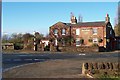
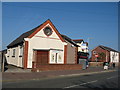
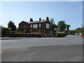
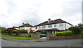
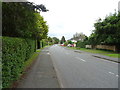
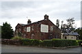
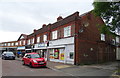
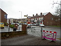
27 photos from this area
Area Information
Key information about the CH61 2XS including its size, population, and administrative classification.
- Area Type
- Postcode
- Area Size
- 2.8 hectares
- Population
- 1445
- Population Density
- 1241 people/km²
House Prices in CH61 2XS
8
Properties
£255,333
Average Sold Price
£90,000
Lowest Price
£390,000
Highest Price
Showing 8 properties
| Address | Type | Beds | Baths | Last Sale Price | Last Sale Date | |
|---|---|---|---|---|---|---|
| 1 Drayton Close, Irby, CH61 2XS | Bungalow | 3 | 1 | £390,000 | May 2024 | |
| 3 Drayton Close, Irby, CH61 2XS | Bungalow | - | - | £350,000 | Mar 2023 | |
| 7 Drayton Close, Irby, CH61 2XS | Bungalow | - | - | £222,000 | Dec 2009 | |
| 5 Drayton Close, Irby, CH61 2XS | Detached | - | - | £250,000 | Mar 2008 | |
| 4 Drayton Close, Irby, CH61 2XS | Detached | - | - | £230,000 | Oct 2003 | |
| 9 Drayton Close, Irby, CH61 2XS | Detached | - | - | £90,000 | Jul 1996 | |
| 11 Drayton Close, Irby, CH61 2XS | Detached | - | - | - | - | |
| 2 Drayton Close, Irby, CH61 2XS | Detached | - | - | - | - |
Energy Efficiency in CH61 2XS
Amenities
Schools
| Rank | School | Type | Entry gender | Ages |
|---|
Explore more schools in this area
Go to Schools tabDemographics
Household Size
Two person
most common
Accommodation Type
Houses
most common
Tenure
87
majority
Ethnic Group
White
most common
Religion
N/A
most common
Household Composition
N/A
most common
Age
47
median
Adults (30-64 years)
most common
Household Deprivation
N/A
with no deprivation
NS-SEC
42
in Lower managerial occupations
Explore more demographic insights in this area
Go to Demographics tabPlanning
Planning Constraints
- Flood RiskPremium
- Ramsar Wetland SitesPremium
- Area of Outstanding Natural BeautyPremium
- Protected Nature ReservePremium
- Protected WoodlandPremium