Area Overview for CH61 2XG
Photos of CH61 2XG
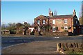
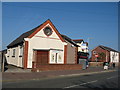
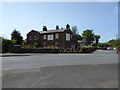
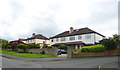
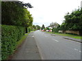
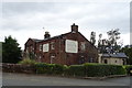
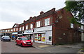
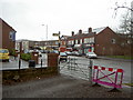
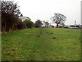
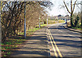
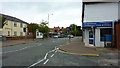
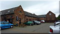
27 photos from this area
Area Information
Key information about the CH61 2XG including its size, population, and administrative classification.
- Area Type
- Postcode
- Area Size
- 1.4 hectares
- Population
- 1445
- Population Density
- 1241 people/km²
House Prices in CH61 2XG
18
Properties
£232,402
Average Sold Price
£108,000
Lowest Price
£386,622
Highest Price
Showing 18 properties
| Address | Type | Beds | Baths | Last Sale Price | Last Sale Date | |
|---|---|---|---|---|---|---|
| 250 Irby Road, Irby, CH61 2XG | Bungalow | 3 | 2 | £386,622 | Jan 2024 | |
| 236 Irby Road, Irby, CH61 2XG | Bungalow | 4 | 3 | £202,000 | Sep 2017 | |
| 220 Irby Road, Irby, CH61 2XG | Bungalow | - | - | £280,000 | Jul 2017 | |
| 244 Irby Road, Irby, CH61 2XG | house | 1 | - | £332,000 | Jul 2015 | |
| 222 Irby Road, Irby, CH61 2XG | Bungalow | 3 | - | £275,500 | Mar 2015 | |
| Ingledene, 254 Irby Road, Irby, CH61 2XG | Detached | - | - | £215,000 | Jul 2008 | |
| 232 Irby Road, Irby, CH61 2XG | Bungalow | - | - | £177,500 | Apr 2004 | |
| 242 Irby Road, Irby, CH61 2XG | Bungalow | 3 | 1 | £115,000 | May 2000 | |
| 234 Irby Road, Irby, CH61 2XG | Detached | - | - | £108,000 | Jun 1999 | |
| Ivanhoe, 230 Irby Road, Irby, CH61 2XG | Detached | - | - | - | - |
Page 1 of 2
Energy Efficiency in CH61 2XG
Amenities
Schools
| Rank | School | Type | Entry gender | Ages |
|---|
Explore more schools in this area
Go to Schools tabDemographics
Household Size
Two person
most common
Accommodation Type
Houses
most common
Tenure
87
majority
Ethnic Group
White
most common
Religion
N/A
most common
Household Composition
N/A
most common
Age
47
median
Adults (30-64 years)
most common
Household Deprivation
N/A
with no deprivation
NS-SEC
42
in Lower managerial occupations
Explore more demographic insights in this area
Go to Demographics tabPlanning
Planning Constraints
- Flood RiskPremium
- Ramsar Wetland SitesPremium
- Area of Outstanding Natural BeautyPremium
- Protected Nature ReservePremium
- Protected WoodlandPremium