Area Overview for CH49 3AP
Photos of CH49 3AP
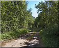
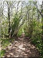
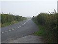
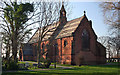
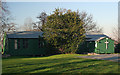
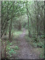
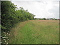
35 photos from this area
Area Information
Key information about the CH49 3AP including its size, population, and administrative classification.
- Area Type
- Postcode
- Area Size
- 1.7 hectares
- Population
- 1294
- Population Density
- 1180 people/km²
House Prices in CH49 3AP
46
Properties
£123,311
Average Sold Price
£24,250
Lowest Price
£234,950
Highest Price
Showing 46 properties
| Address | Type | Beds | Baths | Last Sale Price | Last Sale Date | |
|---|---|---|---|---|---|---|
| 10 Stanmore Park, Greasby, CH49 3AP | Bungalow | 2 | 1 | £220,000 | May 2024 | |
| 35 Stanmore Park, Greasby, CH49 3AP | Bungalow | 2 | 1 | £110,000 | Oct 2023 | |
| 37 Stanmore Park, Greasby, CH49 3AP | Bungalow | - | - | £190,000 | Jul 2022 | |
| 26 Stanmore Park, Greasby, CH49 3AP | Bungalow | 2 | 1 | £70,000 | Dec 2021 | |
| 29 Stanmore Park, Greasby, CH49 3AP | Bungalow | - | - | £215,000 | Oct 2021 | |
| 24 Stanmore Park, Greasby, CH49 3AP | Semi-detached | 2 | 1 | £178,000 | May 2021 | |
| 50 Stanmore Park, Greasby, CH49 3AP | Bungalow | - | - | £168,500 | Mar 2021 | |
| 39 Stanmore Park, Greasby, CH49 3AP | Bungalow | - | - | £80,000 | Feb 2021 | |
| 32 Stanmore Park, Greasby, CH49 3AP | Bungalow | - | - | £162,000 | Jan 2021 | |
| 11 Stanmore Park, Greasby, CH49 3AP | Bungalow | - | - | £157,000 | Jan 2021 |
Page 1 of 5
Energy Efficiency in CH49 3AP
Amenities
Schools
| Rank | School | Type | Entry gender | Ages |
|---|
Explore more schools in this area
Go to Schools tabDemographics
Household Size
One person
most common
Accommodation Type
Houses
most common
Tenure
84
majority
Ethnic Group
White
most common
Religion
N/A
most common
Household Composition
N/A
most common
Age
47
median
Elderly (65+ years)
most common
Household Deprivation
N/A
with no deprivation
NS-SEC
40
in Lower managerial occupations
Explore more demographic insights in this area
Go to Demographics tabPlanning
Planning Constraints
- Flood RiskPremium
- Ramsar Wetland SitesPremium
- Area of Outstanding Natural BeautyPremium
- Protected Nature ReservePremium
- Protected WoodlandPremium