Area Overview for CH46 7UF
Photos of CH46 7UF
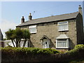

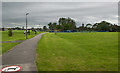
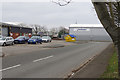
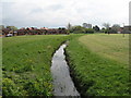
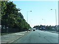
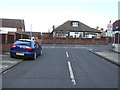
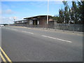
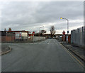
13 photos from this area
Area Information
Key information about the CH46 7UF including its size, population, and administrative classification.
- Area Type
- Postcode
- Area Size
- 1.4 hectares
- Population
- 1524
- Population Density
- 2864 people/km²
House Prices in CH46 7UF
30
Properties
£99,496
Average Sold Price
£24,000
Lowest Price
£178,000
Highest Price
Showing 30 properties
| Address | Type | Beds | Baths | Last Sale Price | Last Sale Date | |
|---|---|---|---|---|---|---|
| 7 Harvest Lane, Moreton, CH46 7UF | house | - | - | £150,000 | Jun 2025 | |
| 35 Harvest Lane, Moreton, CH46 7UF | Semi-detached | 2 | 1 | £174,000 | May 2025 | |
| 29 Harvest Lane, Moreton, CH46 7UF | house | - | - | £178,000 | Dec 2022 | |
| 39 Harvest Lane, Moreton, CH46 7UF | Semi-detached | 2 | 1 | £147,000 | Feb 2022 | |
| 15 Harvest Lane, Moreton, CH46 7UF | house | - | - | £144,000 | Aug 2020 | |
| 59 Harvest Lane, Moreton, CH46 7UF | house | - | - | £104,500 | Aug 2011 | |
| 45 Harvest Lane, Moreton, CH46 7UF | house | - | - | £91,500 | Apr 2009 | |
| 33 Harvest Lane, Moreton, CH46 7UF | Semi-detached | - | - | £88,000 | Sep 2005 | |
| 5 Harvest Lane, Moreton, CH46 7UF | house | - | - | £55,000 | Apr 2002 | |
| 53 Harvest Lane, Moreton, CH46 7UF | house | 3 | - | £43,500 | Jan 2002 |
Page 1 of 3
Energy Efficiency in CH46 7UF
Amenities
Schools
| Rank | School | Type | Entry gender | Ages |
|---|
Explore more schools in this area
Go to Schools tabDemographics
Household Size
One person
most common
Accommodation Type
Houses
most common
Tenure
52
majority
Ethnic Group
White
most common
Religion
N/A
most common
Household Composition
N/A
most common
Age
47
median
Adults (30-64 years)
most common
Household Deprivation
N/A
with no deprivation
NS-SEC
17
in Lower managerial occupations
Explore more demographic insights in this area
Go to Demographics tabPlanning
Planning Constraints
- Flood RiskPremium
- Ramsar Wetland SitesPremium
- Area of Outstanding Natural BeautyPremium
- Protected Nature ReservePremium
- Protected WoodlandPremium