Area Overview for CH46 7SB
Photos of CH46 7SB
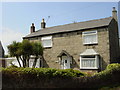

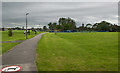
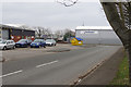
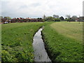
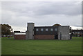
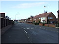
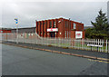
13 photos from this area
Area Information
Key information about the CH46 7SB including its size, population, and administrative classification.
- Area Type
- Postcode
- Area Size
- 8162 m²
- Population
- 1399
- Population Density
- 4019 people/km²
House Prices in CH46 7SB
17
Properties
£154,491
Average Sold Price
£47,000
Lowest Price
£315,000
Highest Price
Showing 17 properties
| Address | Type | Beds | Baths | Last Sale Price | Last Sale Date | |
|---|---|---|---|---|---|---|
| 3 Eleanor Road, Moreton, CH46 7SB | Bungalow | - | - | £315,000 | Oct 2023 | |
| 18 Eleanor Road, Moreton, CH46 7SB | Semi-detached | 2 | 1 | £180,000 | Nov 2022 | |
| 9 Eleanor Road, Moreton, CH46 7SB | Bungalow | 4 | 1 | £172,000 | Jan 2022 | |
| 16 Eleanor Road, Moreton, CH46 7SB | Bungalow | - | - | £139,950 | Oct 2019 | |
| 15 Eleanor Road, Moreton, CH46 7SB | Bungalow | 2 | 1 | £155,000 | Jun 2018 | |
| 10 Eleanor Road, Moreton, CH46 7SB | Semi-detached | 4 | 2 | £155,500 | May 2018 | |
| 12 Eleanor Road, Moreton, CH46 7SB | Bungalow | 3 | 2 | £189,000 | Aug 2012 | |
| 11 Eleanor Road, Moreton, CH46 7SB | Bungalow | 3 | 2 | £156,000 | Nov 2009 | |
| 4 Eleanor Road, Moreton, CH46 7SB | Detached | - | - | £130,000 | Jul 2004 | |
| 17 Eleanor Road, Moreton, CH46 7SB | Bungalow | - | - | £47,000 | Oct 2000 |
Page 1 of 2
Energy Efficiency in CH46 7SB
Amenities
Schools
| Rank | School | Type | Entry gender | Ages |
|---|
Explore more schools in this area
Go to Schools tabDemographics
Household Size
One person
most common
Accommodation Type
Houses
most common
Tenure
58
majority
Ethnic Group
White
most common
Religion
N/A
most common
Household Composition
N/A
most common
Age
47
median
Adults (30-64 years)
most common
Household Deprivation
N/A
with no deprivation
NS-SEC
21
in Lower managerial occupations
Explore more demographic insights in this area
Go to Demographics tabPlanning
Planning Constraints
- Flood RiskPremium
- Ramsar Wetland SitesPremium
- Area of Outstanding Natural BeautyPremium
- Protected Nature ReservePremium
- Protected WoodlandPremium