Area Overview for CH46 7SX
Photos of CH46 7SX
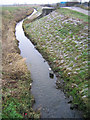

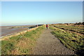
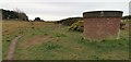

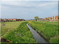
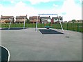
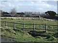
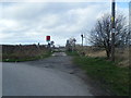
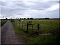
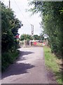
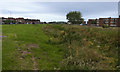
13 photos from this area
Area Information
Key information about the CH46 7SX including its size, population, and administrative classification.
- Area Type
- Postcode
- Area Size
- 1.4 hectares
- Population
- 1399
- Population Density
- 4019 people/km²
House Prices in CH46 7SX
38
Properties
£106,563
Average Sold Price
£15,100
Lowest Price
£175,000
Highest Price
Showing 38 properties
| Address | Type | Beds | Baths | Last Sale Price | Last Sale Date | |
|---|---|---|---|---|---|---|
| 57 Tern Way, Moreton, CH46 7SX | Semi-detached | 3 | 1 | £170,000 | Feb 2024 | |
| 37 Tern Way, Moreton, CH46 7SX | house | 3 | 1 | £160,000 | Nov 2023 | |
| 67 Tern Way, Moreton, CH46 7SX | house | 3 | - | £97,000 | Nov 2022 | |
| 73 Tern Way, Moreton, CH46 7SX | house | - | - | £175,000 | Oct 2022 | |
| 55 Tern Way, Moreton, CH46 7SX | house | - | - | £135,000 | Mar 2021 | |
| 43 Tern Way, Moreton, CH46 7SX | Terraced | 2 | 1 | £93,000 | Jan 2020 | |
| 41 Tern Way, Moreton, CH46 7SX | house | 3 | - | £100,000 | Oct 2019 | |
| 27 Tern Way, Moreton, CH46 7SX | house | - | - | £118,500 | Mar 2019 | |
| 49 Tern Way, Moreton, CH46 7SX | house | 3 | - | £115,000 | Mar 2019 | |
| 53 Tern Way, Moreton, CH46 7SX | Land | 2 | 1 | £100,000 | Mar 2019 |
Page 1 of 4
Energy Efficiency in CH46 7SX
Amenities
Schools
| Rank | School | Type | Entry gender | Ages |
|---|
Explore more schools in this area
Go to Schools tabDemographics
Household Size
One person
most common
Accommodation Type
Houses
most common
Tenure
58
majority
Ethnic Group
White
most common
Religion
N/A
most common
Household Composition
N/A
most common
Age
47
median
Adults (30-64 years)
most common
Household Deprivation
N/A
with no deprivation
NS-SEC
21
in Lower managerial occupations
Explore more demographic insights in this area
Go to Demographics tabPlanning
Planning Constraints
- Flood RiskPremium
- Ramsar Wetland SitesPremium
- Area of Outstanding Natural BeautyPremium
- Protected Nature ReservePremium
- Protected WoodlandPremium