Area Overview for CH46 7SP
Photos of CH46 7SP
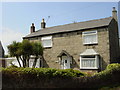
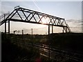
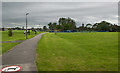
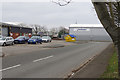
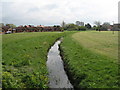
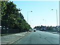
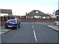
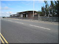
13 photos from this area
Area Information
Key information about the CH46 7SP including its size, population, and administrative classification.
- Area Type
- Postcode
- Area Size
- 1.5 hectares
- Population
- 1399
- Population Density
- 4019 people/km²
House Prices in CH46 7SP
35
Properties
£102,313
Average Sold Price
£37,950
Lowest Price
£160,000
Highest Price
Showing 35 properties
| Address | Type | Beds | Baths | Last Sale Price | Last Sale Date | |
|---|---|---|---|---|---|---|
| 51 Curlew Way, Moreton, CH46 7SP | Terraced | 3 | 1 | £160,000 | Sep 2024 | |
| 39 Curlew Way, Moreton, CH46 7SP | Terraced | 3 | 1 | £155,000 | Feb 2024 | |
| 41 Curlew Way, Moreton, CH46 7SP | Terraced | 3 | 1 | £157,500 | Sep 2023 | |
| 21 Curlew Way, Moreton, CH46 7SP | house | - | - | £95,000 | Feb 2020 | |
| 31 Curlew Way, Moreton, CH46 7SP | Semi-detached | 3 | 1 | £130,000 | Jul 2018 | |
| 43 Curlew Way, Moreton, CH46 7SP | house | - | - | £124,950 | Jan 2016 | |
| 63 Curlew Way, Moreton, CH46 7SP | house | - | - | £98,000 | Dec 2015 | |
| 37 Curlew Way, Moreton, CH46 7SP | house | - | - | £110,000 | Jan 2014 | |
| 61 Curlew Way, Moreton, CH46 7SP | Terraced | 3 | 1 | £95,000 | Oct 2011 | |
| 33 Curlew Way, Moreton, CH46 7SP | house | - | - | £115,000 | May 2011 |
Page 1 of 4
Energy Efficiency in CH46 7SP
Amenities
Schools
| Rank | School | Type | Entry gender | Ages |
|---|
Explore more schools in this area
Go to Schools tabDemographics
Household Size
One person
most common
Accommodation Type
Houses
most common
Tenure
58
majority
Ethnic Group
White
most common
Religion
N/A
most common
Household Composition
N/A
most common
Age
47
median
Adults (30-64 years)
most common
Household Deprivation
N/A
with no deprivation
NS-SEC
21
in Lower managerial occupations
Explore more demographic insights in this area
Go to Demographics tabPlanning
Planning Constraints
- Flood RiskPremium
- Ramsar Wetland SitesPremium
- Area of Outstanding Natural BeautyPremium
- Protected Nature ReservePremium
- Protected WoodlandPremium