Area Overview for CH43 7NY
Photos of CH43 7NY


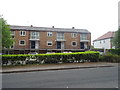
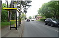

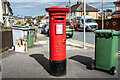
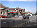
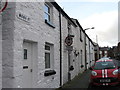
36 photos from this area
Area Information
Key information about the CH43 7NY including its size, population, and administrative classification.
- Area Type
- Postcode
- Area Size
- 8500 m²
- Population
- 1603
- Population Density
- 188584 people/km²
House Prices in CH43 7NY
20
Properties
£97,518
Average Sold Price
£41,325
Lowest Price
£205,000
Highest Price
Showing 20 properties
| Address | Type | Beds | Baths | Last Sale Price | Last Sale Date | |
|---|---|---|---|---|---|---|
| 5 Elmtree Grove, Bidston, CH43 7NY | Semi-detached | 2 | 1 | £151,500 | Jan 2025 | |
| 3 Elmtree Grove, Bidston, CH43 7NY | Detached | 2 | 1 | £205,000 | Sep 2022 | |
| 14 Elmtree Grove, Bidston, CH43 7NY | Semi-detached | 3 | 1 | £121,885 | Aug 2022 | |
| 16 Elmtree Grove, Bidston, CH43 7NY | house | - | - | £115,000 | Sep 2021 | |
| 7 Elmtree Grove, Bidston, CH43 7NY | Semi-detached | 2 | 1 | £110,000 | Oct 2019 | |
| 12 Elmtree Grove, Bidston, CH43 7NY | Semi-detached | 3 | - | £95,000 | Oct 2015 | |
| 2 Elmtree Grove, Bidston, CH43 7NY | Detached | 3 | 2 | £134,500 | Feb 2015 | |
| 8 Elmtree Grove, Bidston, CH43 7NY | Semi-detached | 2 | 1 | £60,000 | May 2013 | |
| 1 Elmtree Grove, Bidston, CH43 7NY | Semi-detached | 2 | - | £107,000 | Nov 2011 | |
| 28 Elmtree Grove, Bidston, CH43 7NY | Terraced | 2 | - | £105,000 | Aug 2007 |
Page 1 of 2
Energy Efficiency in CH43 7NY
Amenities
Schools
| Rank | School | Type | Entry gender | Ages |
|---|
Explore more schools in this area
Go to Schools tabDemographics
Household Size
Family (3-5 people)
most common
Accommodation Type
Houses
most common
Tenure
31
majority
Ethnic Group
White
most common
Religion
N/A
most common
Household Composition
N/A
most common
Age
47
median
Adults (30-64 years)
most common
Household Deprivation
N/A
with no deprivation
NS-SEC
16
in Lower managerial occupations
Explore more demographic insights in this area
Go to Demographics tabPlanning
Planning Constraints
- Flood RiskPremium
- Ramsar Wetland SitesPremium
- Area of Outstanding Natural BeautyPremium
- Protected Nature ReservePremium
- Protected WoodlandPremium