Area Overview for CH43 7NX
Photos of CH43 7NX


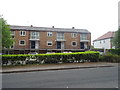
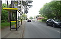

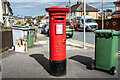
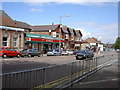
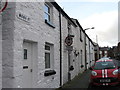
36 photos from this area
Area Information
Key information about the CH43 7NX including its size, population, and administrative classification.
- Area Type
- Postcode
- Area Size
- 1.5 hectares
- Population
- 1603
- Population Density
- 5660 people/km²
House Prices in CH43 7NX
48
Properties
£109,319
Average Sold Price
£29,000
Lowest Price
£275,000
Highest Price
Showing 48 properties
| Address | Type | Beds | Baths | Last Sale Price | Last Sale Date | |
|---|---|---|---|---|---|---|
| 17 Oakwood Drive, Bidston, CH43 7NX | house | 3 | 1 | £246,000 | Mar 2025 | |
| 29 Oakwood Drive, Bidston, CH43 7NX | Semi-detached | 3 | 1 | £167,000 | Dec 2024 | |
| 23 Oakwood Drive, Bidston, CH43 7NX | Detached | 3 | 1 | £175,000 | Nov 2024 | |
| 2 Oakwood Drive, Bidston, CH43 7NX | Detached | 4 | 2 | £275,000 | Oct 2024 | |
| 41 Oakwood Drive, Bidston, CH43 7NX | Terraced | 2 | 1 | £128,000 | Apr 2024 | |
| 24 Oakwood Drive, Bidston, CH43 7NX | Semi-detached | 3 | 1 | £160,000 | Aug 2023 | |
| 32 Oakwood Drive, Bidston, CH43 7NX | Terraced | 2 | 1 | £117,500 | Apr 2023 | |
| 40 Oakwood Drive, Bidston, CH43 7NX | Detached | 3 | 1 | £160,000 | Jun 2022 | |
| 16 Oakwood Drive, Bidston, CH43 7NX | house | - | - | £109,000 | Jan 2022 | |
| 19 Oakwood Drive, Bidston, CH43 7NX | Semi-detached | 2 | 1 | £95,000 | Nov 2021 |
Page 1 of 5
Energy Efficiency in CH43 7NX
Amenities
Schools
| Rank | School | Type | Entry gender | Ages |
|---|
Explore more schools in this area
Go to Schools tabDemographics
Household Size
Family (3-5 people)
most common
Accommodation Type
Houses
most common
Tenure
31
majority
Ethnic Group
White
most common
Religion
N/A
most common
Household Composition
N/A
most common
Age
47
median
Adults (30-64 years)
most common
Household Deprivation
N/A
with no deprivation
NS-SEC
16
in Lower managerial occupations
Explore more demographic insights in this area
Go to Demographics tabPlanning
Planning Constraints
- Flood RiskPremium
- Ramsar Wetland SitesPremium
- Area of Outstanding Natural BeautyPremium
- Protected Nature ReservePremium
- Protected WoodlandPremium