Area Overview for CH2 4NS
Photos of CH2 4NS
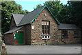
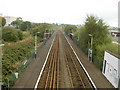
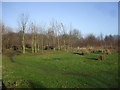
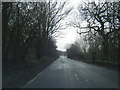
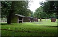
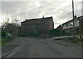
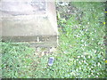

12 photos from this area
Area Information
Key information about the CH2 4NS including its size, population, and administrative classification.
- Area Type
- Postcode
- Area Size
- 1.2 km²
- Population
- 2669
- Population Density
- 141 people/km²
House Prices in CH2 4NS
15
Properties
£214,750
Average Sold Price
£58,000
Lowest Price
£310,000
Highest Price
Showing 15 properties
| Address | Type | Beds | Baths | Last Sale Price | Last Sale Date | |
|---|---|---|---|---|---|---|
| New Hall Barn, Kinseys Lane, Ince, CH2 4NS | Semi-detached | 6 | 2 | £310,000 | Aug 2021 | |
| 4, Park Cottages, Kinseys Lane, Ince, CH2 4NS | house | 2 | 1 | £185,500 | Mar 2020 | |
| Daleside, 1A Kinseys Lane, Ince, CH2 4NS | house | 3 | 1 | £260,000 | Jun 2018 | |
| Old Hall Barn, Kinseys Lane, Ince, CH2 4NS | house | 5 | - | £305,000 | Dec 2014 | |
| 3, Park Cottages, Kinseys Lane, Ince, CH2 4NS | house | - | - | £170,000 | Nov 2004 | |
| Badger Cottage, Kinseys Lane, Ince, CH2 4NS | Detached | - | - | £58,000 | Mar 2003 | |
| 2, Park Cottages, Kinseys Lane, Ince, CH2 4NS | Terraced | 3 | 1 | - | - | |
| 1, Park Cottages, Kinseys Lane, Ince, CH2 4NS | Cottage | 2 | 1 | - | - | |
| Land Adjacent Wood Farm, Kinseys Lane, Ince, CH2 4NS | Detached | - | - | - | - | |
| Annexe, Old Hall Barn, Kinseys Lane, Ince, CH2 4NS | Flat | - | - | - | - |
Page 1 of 2
Energy Efficiency in CH2 4NS
Amenities
Schools
| Rank | School | Type | Entry gender | Ages |
|---|
Explore more schools in this area
Go to Schools tabDemographics
Household Size
Two person
most common
Accommodation Type
Houses
most common
Tenure
60
majority
Ethnic Group
White
most common
Religion
N/A
most common
Household Composition
N/A
most common
Age
47
median
Adults (30-64 years)
most common
Household Deprivation
N/A
with no deprivation
NS-SEC
26
in Lower managerial occupations
Explore more demographic insights in this area
Go to Demographics tabPlanning
Planning Constraints
- Flood RiskPremium
- Area of Outstanding Natural BeautyPremium
- Protected Nature ReservePremium
- Protected WoodlandPremium