Area Overview for CH2 3RT
Photos of CH2 3RT
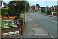


51 photos from this area
Area Information
Key information about the CH2 3RT including its size, population, and administrative classification.
- Area Type
- Postcode
- Area Size
- 1.4 hectares
- Population
- 1478
- Population Density
- 4786 people/km²
House Prices in CH2 3RT
20
Properties
£231,684
Average Sold Price
£65,000
Lowest Price
£468,000
Highest Price
Showing 20 properties
| Address | Type | Beds | Baths | Last Sale Price | Last Sale Date | |
|---|---|---|---|---|---|---|
| The Cottage, 55 Mannings Lane South, Chester, CH2 3RT | house | - | - | £355,000 | Jan 2022 | |
| 47 Mannings Lane South, Chester, CH2 3RT | Retail | 3 | 1 | £340,000 | Nov 2021 | |
| The Monkey Tree, 59A Mannings Lane South, Chester, CH2 3RT | house | - | - | £425,000 | Mar 2020 | |
| 49 Mannings Lane South, Chester, CH2 3RT | Bungalow | 2 | 1 | £260,000 | Jan 2020 | |
| 66 Mannings Lane South, Chester, CH2 3RT | Bungalow | - | - | £200,500 | Mar 2019 | |
| Elm Cottage, 53 Mannings Lane South, Chester, CH2 3RT | house | - | - | £269,000 | Dec 2015 | |
| 62 Mannings Lane South, Chester, CH2 3RT | Semi-detached | 3 | 1 | £182,000 | Jul 2015 | |
| Hillcrest, 43 Mannings Lane South, Chester, CH2 3RT | Semi-detached | 3 | 1 | £268,000 | Sep 2014 | |
| Cranfield, 57 Mannings Lane South, Chester, CH2 3RT | Bungalow | - | - | £468,000 | Sep 2014 | |
| 68 Mannings Lane South, Chester, CH2 3RT | Semi-detached | 3 | 1 | £173,000 | Jan 2014 |
Page 1 of 2
Energy Efficiency in CH2 3RT
Amenities
Schools
| Rank | School | Type | Entry gender | Ages |
|---|
Explore more schools in this area
Go to Schools tabDemographics
Household Size
Two person
most common
Accommodation Type
Houses
most common
Tenure
89
majority
Ethnic Group
White
most common
Religion
N/A
most common
Household Composition
N/A
most common
Age
47
median
Adults (30-64 years)
most common
Household Deprivation
N/A
with no deprivation
NS-SEC
49
in Lower managerial occupations
Explore more demographic insights in this area
Go to Demographics tabPlanning
Planning Constraints
- Flood RiskPremium
- Ramsar Wetland SitesPremium
- Area of Outstanding Natural BeautyPremium
- Protected Nature ReservePremium
- Protected WoodlandPremium