Area Overview for CH2 3NH
Photos of CH2 3NH
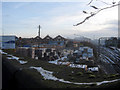


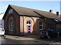
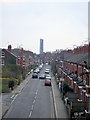
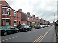


100 photos from this area
Area Information
Key information about the CH2 3NH including its size, population, and administrative classification.
- Area Type
- Postcode
- Area Size
- 1.5 hectares
- Population
- 1528
- Population Density
- 5341 people/km²
House Prices in CH2 3NH
60
Properties
£318,333
Average Sold Price
£155,000
Lowest Price
£450,000
Highest Price
Showing 60 properties
| Address | Type | Beds | Baths | Last Sale Price | Last Sale Date | |
|---|---|---|---|---|---|---|
| 9 Hoole Road, Chester, CH2 3NH | house | 1 | 1 | £295,000 | Jul 2023 | |
| 2A Hoole Road, Chester, CH2 3NH | house | - | - | £450,000 | Jun 2021 | |
| 2 Hoole Road, Chester, CH2 3NH | Detached | 1 | 1 | £395,000 | Mar 2018 | |
| 27 Hoole Road, Chester, CH2 3NH | secure_residential | 1 | 3 | £380,000 | Oct 2017 | |
| 47A Hoole Road, Chester, CH2 3NH | Flat | - | - | £155,000 | Jul 2015 | |
| 7 Hoole Road, Chester, CH2 3NH | Terraced | - | - | £235,000 | Mar 2004 | |
| Maisonette, 11 Hoole Road, Chester, CH2 3NH | Terraced | 4 | 2 | - | - | |
| 37 Hoole Road, Chester, CH2 3NH | house | 4 | - | - | - | |
| 53 Hoole Road, Chester, CH2 3NH | undefined | - | - | - | - | |
| Devonia Hotel, 33 Hoole Road, Chester, CH2 3NH | Detached | - | - | - | - |
Page 1 of 6
Energy Efficiency in CH2 3NH
Amenities
Schools
| Rank | School | Type | Entry gender | Ages |
|---|
Explore more schools in this area
Go to Schools tabDemographics
Household Size
One person
most common
Accommodation Type
Houses
most common
Tenure
34
majority
Ethnic Group
White
most common
Religion
N/A
most common
Household Composition
N/A
most common
Age
47
median
Adults (30-64 years)
most common
Household Deprivation
N/A
with no deprivation
NS-SEC
40
in Lower managerial occupations
Explore more demographic insights in this area
Go to Demographics tabPlanning
Planning Constraints
- Flood RiskPremium
- Ramsar Wetland SitesPremium
- Area of Outstanding Natural BeautyPremium
- Protected Nature ReservePremium
- Protected WoodlandPremium