Area Overview for CH2 3DD
Photos of CH2 3DD
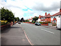


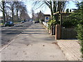


55 photos from this area
Area Information
Key information about the CH2 3DD including its size, population, and administrative classification.
- Area Type
- Postcode
- Area Size
- 1.0 hectares
- Population
- Not available
- Population Density
- Not available
House Prices in CH2 3DD
15
Properties
£157,639
Average Sold Price
£126,000
Lowest Price
£180,000
Highest Price
Showing 15 properties
| Address | Type | Beds | Baths | Last Sale Price | Last Sale Date | |
|---|---|---|---|---|---|---|
| 4 Bishopsgate, Chester, CH2 3DD | Flat | - | - | £180,000 | Mar 2024 | |
| 6 Bishopsgate, Chester, CH2 3DD | Flat | 2 | 1 | £175,000 | Jan 2024 | |
| 11 Bishopsgate, Chester, CH2 3DD | Flat | - | - | £155,000 | Oct 2023 | |
| 15 Bishopsgate, Chester, CH2 3DD | Flat | - | - | £180,000 | Jan 2023 | |
| 5 Bishopsgate, Chester, CH2 3DD | Flat | - | - | £155,500 | Jul 2021 | |
| 8 Bishopsgate, Chester, CH2 3DD | Flat | - | - | £167,000 | Sep 2020 | |
| 7 Bishopsgate, Chester, CH2 3DD | Flat | 2 | - | £157,000 | Jul 2020 | |
| 1 Bishopsgate, Chester, CH2 3DD | Flat | 2 | - | £152,500 | Sep 2019 | |
| 12 Bishopsgate, Chester, CH2 3DD | Flat | 2 | 1 | £163,000 | Jul 2018 | |
| 14 Bishopsgate, Chester, CH2 3DD | Flat | - | - | £160,000 | Apr 2018 |
Page 1 of 2
Energy Efficiency in CH2 3DD
Amenities
Schools
| Rank | School | Type | Entry gender | Ages |
|---|
Explore more schools in this area
Go to Schools tabDemographics
Household Size
Two person
most common
Accommodation Type
Houses
most common
Tenure
62
majority
Ethnic Group
White
most common
Religion
N/A
most common
Household Composition
N/A
most common
Age
47
median
Adults (30-64 years)
most common
Household Deprivation
N/A
with no deprivation
NS-SEC
52
in Lower managerial occupations
Explore more demographic insights in this area
Go to Demographics tabPlanning
Planning Constraints
- Flood RiskPremium
- Ramsar Wetland SitesPremium
- Area of Outstanding Natural BeautyPremium
- Protected Nature ReservePremium
- Protected WoodlandPremium