Area Overview for CH2 2PG
Photos of CH2 2PG
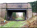
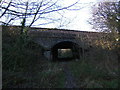
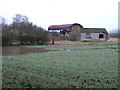
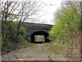
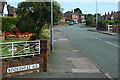
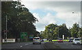
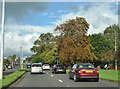
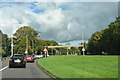
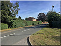
51 photos from this area
Area Information
Key information about the CH2 2PG including its size, population, and administrative classification.
- Area Type
- Postcode
- Area Size
- 1.1 hectares
- Population
- 1983
- Population Density
- 4447 people/km²
House Prices in CH2 2PG
22
Properties
£187,044
Average Sold Price
£35,000
Lowest Price
£323,000
Highest Price
Showing 22 properties
| Address | Type | Beds | Baths | Last Sale Price | Last Sale Date | |
|---|---|---|---|---|---|---|
| 59 Long Lane, Chester, CH2 2PG | Detached | 3 | 1 | £284,000 | Dec 2024 | |
| 57 Long Lane, Chester, CH2 2PG | Semi-detached | 3 | 1 | £312,500 | Jul 2024 | |
| 33 Long Lane, Chester, CH2 2PG | house | - | - | £323,000 | Mar 2022 | |
| 41 Long Lane, Chester, CH2 2PG | house | - | - | £316,750 | Feb 2022 | |
| 51 Long Lane, Chester, CH2 2PG | house | 3 | - | £265,000 | Apr 2019 | |
| 61 Long Lane, Chester, CH2 2PG | Semi-detached | 3 | 1 | £220,000 | Feb 2016 | |
| 31 Long Lane, Chester, CH2 2PG | Terraced | 3 | - | £183,000 | Apr 2015 | |
| 35 Long Lane, Chester, CH2 2PG | Semi-detached | 3 | - | £168,000 | Jun 2013 | |
| 55 Long Lane, Chester, CH2 2PG | house | - | - | £198,000 | Aug 2009 | |
| 69 Long Lane, Chester, CH2 2PG | house | - | - | £132,000 | Nov 2003 |
Page 1 of 3
Energy Efficiency in CH2 2PG
Amenities
Schools
| Rank | School | Type | Entry gender | Ages |
|---|
Explore more schools in this area
Go to Schools tabDemographics
Household Size
One person
most common
Accommodation Type
Houses
most common
Tenure
79
majority
Ethnic Group
White
most common
Religion
N/A
most common
Household Composition
N/A
most common
Age
47
median
Adults (30-64 years)
most common
Household Deprivation
N/A
with no deprivation
NS-SEC
43
in Lower managerial occupations
Explore more demographic insights in this area
Go to Demographics tabPlanning
Planning Constraints
- Flood RiskPremium
- Ramsar Wetland SitesPremium
- Area of Outstanding Natural BeautyPremium
- Protected Nature ReservePremium
- Protected WoodlandPremium