Area Overview for CH2 1PP
Photos of CH2 1PP
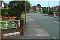
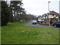
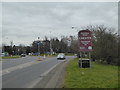
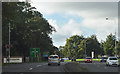
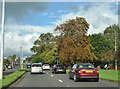
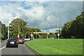
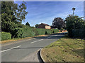
51 photos from this area
Area Information
Key information about the CH2 1PP including its size, population, and administrative classification.
- Area Type
- Postcode
- Area Size
- 1.1 hectares
- Population
- 1983
- Population Density
- 4447 people/km²
House Prices in CH2 1PP
28
Properties
£168,513
Average Sold Price
£55,000
Lowest Price
£367,000
Highest Price
Showing 28 properties
| Address | Type | Beds | Baths | Last Sale Price | Last Sale Date | |
|---|---|---|---|---|---|---|
| 92 Plas Newton Lane, Chester, CH2 1PP | Semi-detached | - | - | £219,000 | May 2007 | |
| 112 Plas Newton Lane, Chester, CH2 1PP | Semi-detached | 3 | 1 | £180,000 | Mar 2007 | |
| 98 Plas Newton Lane, Chester, CH2 1PP | Semi-detached | 3 | 2 | £198,000 | Sep 2006 | |
| 118 Plas Newton Lane, Chester, CH2 1PP | Detached | - | - | £367,000 | Sep 2006 | |
| 132 Plas Newton Lane, Chester, CH2 1PP | house | - | - | £245,000 | Nov 2005 | |
| 88 Plas Newton Lane, Chester, CH2 1PP | Detached | 6 | 2 | £360,000 | Sep 2005 | |
| 124 Plas Newton Lane, Chester, CH2 1PP | Detached | - | - | £240,000 | Apr 2004 | |
| 82 Plas Newton Lane, Chester, CH2 1PP | Semi-detached | 4 | 3 | £158,000 | Mar 2004 | |
| 122 Plas Newton Lane, Chester, CH2 1PP | house | - | - | £122,000 | Jul 2002 | |
| 110 Plas Newton Lane, Chester, CH2 1PP | Detached | 3 | 1 | £99,950 | Sep 2000 |
Page 1 of 3
Energy Efficiency in CH2 1PP
Amenities
Schools
| Rank | School | Type | Entry gender | Ages |
|---|
Explore more schools in this area
Go to Schools tabDemographics
Household Size
One person
most common
Accommodation Type
Houses
most common
Tenure
79
majority
Ethnic Group
White
most common
Religion
N/A
most common
Household Composition
N/A
most common
Age
47
median
Adults (30-64 years)
most common
Household Deprivation
N/A
with no deprivation
NS-SEC
43
in Lower managerial occupations
Explore more demographic insights in this area
Go to Demographics tabPlanning
Planning Constraints
- Flood RiskPremium
- Ramsar Wetland SitesPremium
- Area of Outstanding Natural BeautyPremium
- Protected Nature ReservePremium
- Protected WoodlandPremium