Area Overview for CA28 9AY
Photos of CA28 9AY
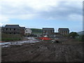
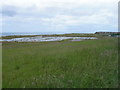
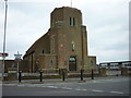
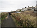
24 photos from this area
Area Information
Key information about the CA28 9AY including its size, population, and administrative classification.
- Area Type
- Postcode
- Area Size
- 7472 m²
- Population
- 1436
- Population Density
- 1762 people/km²
House Prices in CA28 9AY
40
Properties
£64,241
Average Sold Price
£18,000
Lowest Price
£89,000
Highest Price
Showing 40 properties
| Address | Type | Beds | Baths | Last Sale Price | Last Sale Date | |
|---|---|---|---|---|---|---|
| 15 South Row, Whitehaven, CA28 9AY | house | - | - | £82,000 | Jul 2022 | |
| 35 South Row, Whitehaven, CA28 9AY | Terraced | 2 | 1 | £76,500 | Jun 2022 | |
| 38 South Row, Whitehaven, CA28 9AY | Terraced | 3 | 1 | £75,000 | May 2022 | |
| 36 South Row, Whitehaven, CA28 9AY | Terraced | 2 | 2 | £72,500 | Feb 2022 | |
| 33 South Row, Whitehaven, CA28 9AY | Terraced | 3 | 1 | £81,000 | Dec 2021 | |
| 26 South Row, Whitehaven, CA28 9AY | house | - | - | £80,000 | Dec 2021 | |
| 13 South Row, Whitehaven, CA28 9AY | house | - | - | £81,000 | Sep 2021 | |
| 27 South Row, Whitehaven, CA28 9AY | Terraced | 2 | 1 | £70,000 | Jul 2021 | |
| 18 South Row, Whitehaven, CA28 9AY | Terraced | 3 | 1 | £78,000 | Apr 2021 | |
| 40 South Row, Whitehaven, CA28 9AY | Terraced | 2 | 1 | £65,000 | Apr 2021 |
Page 1 of 4
Energy Efficiency in CA28 9AY
Amenities
Schools
| Rank | School | Type | Entry gender | Ages |
|---|
Explore more schools in this area
Go to Schools tabDemographics
Household Size
One person
most common
Accommodation Type
Houses
most common
Tenure
65
majority
Ethnic Group
White
most common
Religion
N/A
most common
Household Composition
N/A
most common
Age
47
median
Adults (30-64 years)
most common
Household Deprivation
N/A
with no deprivation
NS-SEC
24
in Lower managerial occupations
Explore more demographic insights in this area
Go to Demographics tabPlanning
Planning Constraints
- Flood RiskPremium
- Ramsar Wetland SitesPremium
- Area of Outstanding Natural BeautyPremium
- Protected Nature ReservePremium
- Protected WoodlandPremium