Area Overview for CA12 4LT
Photos of CA12 4LT
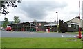
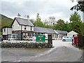
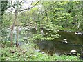
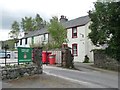
100 photos from this area
Area Information
Key information about the CA12 4LT including its size, population, and administrative classification.
- Area Type
- Postcode
- Area Size
- 3.4 hectares
- Population
- 1400
- Population Density
- 20 people/km²
House Prices in CA12 4LT
14
Properties
£354,125
Average Sold Price
£85,000
Lowest Price
£600,000
Highest Price
Showing 14 properties
| Address | Type | Beds | Baths | Last Sale Price | Last Sale Date | |
|---|---|---|---|---|---|---|
| Toll Bar Cottage, Chestnut Hill, Keswick, CA12 4LT | Cottage | 2 | 2 | £390,000 | Jul 2025 | |
| Manor Top, Chestnut Hill, Keswick, CA12 4LT | Bungalow | - | - | £600,000 | Apr 2019 | |
| THE VIEW, CHESTNUT HILL, Keswick, CA12 4LT | Detached | 3 | 3 | £478,999 | Jan 2014 | |
| Little Bield, Chestnut Hill, Keswick, CA12 4LT | Bungalow | - | - | £450,000 | Jul 2009 | |
| Skiddaw Heights, Chestnut Hill, Keswick, CA12 4LT | Bungalow | - | - | £449,000 | May 2004 | |
| Daffodil Bank, Chestnut Hill, Keswick, CA12 4LT | Bungalow | - | - | £85,000 | Feb 2000 | |
| Castlerigg Cottage, Chestnut Hill, Keswick, CA12 4LT | Cottage | 2 | 2 | £137,000 | Nov 1998 | |
| Sweetbriars, Chestnut Hill, Keswick, CA12 4LT | house | - | - | £243,000 | Jul 1998 | |
| Bowplace, Chestnut Hill, Keswick, CA12 4LT | Detached | 3 | 2 | - | - | |
| Claremont, Chestnut Hill, Keswick, CA12 4LT | Detached | - | - | - | - |
Page 1 of 2
Energy Efficiency in CA12 4LT
Amenities
Schools
| Rank | School | Type | Entry gender | Ages |
|---|
Explore more schools in this area
Go to Schools tabDemographics
Household Size
Two person
most common
Accommodation Type
Houses
most common
Tenure
83
majority
Ethnic Group
White
most common
Religion
N/A
most common
Household Composition
N/A
most common
Age
47
median
Adults (30-64 years)
most common
Household Deprivation
N/A
with no deprivation
NS-SEC
36
in Lower managerial occupations
Explore more demographic insights in this area
Go to Demographics tabPlanning
Planning Constraints
- Flood RiskPremium
- Ramsar Wetland SitesPremium
- Area of Outstanding Natural BeautyPremium
- Protected Nature ReservePremium
- Protected WoodlandPremium