Area Overview for CA12 4LR
Photos of CA12 4LR
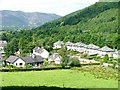
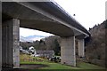
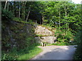
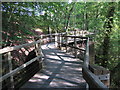
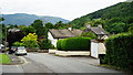
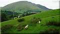
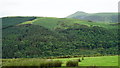
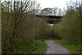
96 photos from this area
Area Information
Key information about the CA12 4LR including its size, population, and administrative classification.
- Area Type
- Postcode
- Area Size
- 6.9 hectares
- Population
- 1400
- Population Density
- 20 people/km²
House Prices in CA12 4LR
20
Properties
£370,963
Average Sold Price
£112,000
Lowest Price
£750,000
Highest Price
Showing 20 properties
| Address | Type | Beds | Baths | Last Sale Price | Last Sale Date | |
|---|---|---|---|---|---|---|
| Jaytrees, Chestnut Hill, Keswick, CA12 4LR | Bungalow | 3 | 2 | £300,000 | Mar 2025 | |
| York House, Chestnut Hill, Keswick, CA12 4LR | house | 3 | - | £750,000 | Jun 2024 | |
| Sunny Bank, Chestnut Hill, Keswick, CA12 4LR | Semi-detached | 3 | 1 | £487,125 | Jun 2024 | |
| Hazel Lodge, Chestnut Hill, Keswick, CA12 4LR | Bungalow | 2 | 1 | £500,000 | Jan 2024 | |
| The Screes, Chestnut Hill, Keswick, CA12 4LR | Semi-detached | 5 | - | £550,000 | Dec 2018 | |
| Woodleigh, Chestnut Hill, Keswick, CA12 4LR | Semi-detached | 4 | 2 | £350,000 | Oct 2016 | |
| Kintail, Chestnut Hill, Keswick, CA12 4LR | Bungalow | - | - | £178,000 | Sep 2001 | |
| The Garth, Chestnut Hill, Keswick, CA12 4LR | Detached | - | - | £280,000 | Jun 1998 | |
| Gateside, Chestnut Hill, Keswick, CA12 4LR | Detached | - | - | £112,000 | Jul 1997 | |
| Maple Lodge, Chestnut Hill, Keswick, CA12 4LR | Detached | - | - | £202,500 | Jun 1996 |
Page 1 of 2
Energy Efficiency in CA12 4LR
Amenities
Schools
| Rank | School | Type | Entry gender | Ages |
|---|
Explore more schools in this area
Go to Schools tabDemographics
Household Size
Two person
most common
Accommodation Type
Houses
most common
Tenure
83
majority
Ethnic Group
White
most common
Religion
N/A
most common
Household Composition
N/A
most common
Age
47
median
Adults (30-64 years)
most common
Household Deprivation
N/A
with no deprivation
NS-SEC
36
in Lower managerial occupations
Explore more demographic insights in this area
Go to Demographics tabPlanning
Planning Constraints
- Flood RiskPremium
- Ramsar Wetland SitesPremium
- Area of Outstanding Natural BeautyPremium
- Protected Nature ReservePremium
- Protected WoodlandPremium