Area Overview for BL9 9RQ
Photos of BL9 9RQ
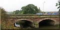

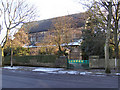
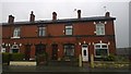
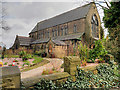
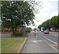
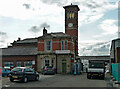
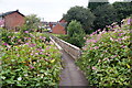
38 photos from this area
Area Information
Key information about the BL9 9RQ including its size, population, and administrative classification.
- Area Type
- Postcode
- Area Size
- 8407 m²
- Population
- 1734
- Population Density
- 1885 people/km²
House Prices in BL9 9RQ
10
Properties
£99,571
Average Sold Price
£27,000
Lowest Price
£177,500
Highest Price
Showing 10 properties
| Address | Type | Beds | Baths | Last Sale Price | Last Sale Date | |
|---|---|---|---|---|---|---|
| 38 Tennyson Avenue, Bury, BL9 9RQ | house | - | - | £146,500 | Nov 2021 | |
| 40 Tennyson Avenue, Bury, BL9 9RQ | Semi-detached | 3 | 1 | £116,000 | Oct 2016 | |
| 30 Tennyson Avenue, Bury, BL9 9RQ | Semi-detached | 4 | - | £177,500 | Mar 2016 | |
| 36 Tennyson Avenue, Bury, BL9 9RQ | Semi-detached | 3 | 1 | £110,000 | Feb 2016 | |
| 32 Tennyson Avenue, Bury, BL9 9RQ | Semi-detached | - | - | £84,000 | Oct 2013 | |
| 15 Tennyson Avenue, Bury, BL9 9RQ | house | - | - | £36,000 | Sep 1995 | |
| 19 Tennyson Avenue, Bury, BL9 9RQ | Semi-detached | - | - | £27,000 | Aug 1995 | |
| 34 Tennyson Avenue, Bury, BL9 9RQ | house | - | - | - | - | |
| 42 Tennyson Avenue, Bury, BL9 9RQ | house | - | - | - | - | |
| 17 Tennyson Avenue, Bury, BL9 9RQ | house | - | - | - | - |
Energy Efficiency in BL9 9RQ
Amenities
Schools
| Rank | School | Type | Entry gender | Ages |
|---|
Explore more schools in this area
Go to Schools tabDemographics
Household Size
Two person
most common
Accommodation Type
Houses
most common
Tenure
75
majority
Ethnic Group
White
most common
Religion
N/A
most common
Household Composition
N/A
most common
Age
47
median
Adults (30-64 years)
most common
Household Deprivation
N/A
with no deprivation
NS-SEC
32
in Lower managerial occupations
Explore more demographic insights in this area
Go to Demographics tabPlanning
Planning Constraints
- Flood RiskPremium
- Ramsar Wetland SitesPremium
- Area of Outstanding Natural BeautyPremium
- Protected Nature ReservePremium
- Protected WoodlandPremium