Area Overview for BL9 9AL
Photos of BL9 9AL
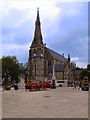
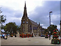
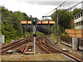
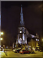
100 photos from this area
Area Information
Key information about the BL9 9AL including its size, population, and administrative classification.
- Area Type
- Postcode
- Area Size
- 8851 m²
- Population
- 2235
- Population Density
- 7744 people/km²
House Prices in BL9 9AL
30
Properties
£90,211
Average Sold Price
£20,000
Lowest Price
£190,000
Highest Price
Showing 30 properties
| Address | Type | Beds | Baths | Last Sale Price | Last Sale Date | |
|---|---|---|---|---|---|---|
| 178 Parkhills Road, Bury, BL9 9AL | Semi-detached | 3 | 1 | £190,000 | Jan 2023 | |
| 220 Parkhills Road, Bury, BL9 9AL | house | - | - | £104,500 | Aug 2020 | |
| 200 Parkhills Road, Bury, BL9 9AL | Detached | 3 | - | £106,000 | Feb 2017 | |
| 184 Parkhills Road, Bury, BL9 9AL | Semi-detached | 3 | 1 | £105,000 | Aug 2016 | |
| 228 Parkhills Road, Bury, BL9 9AL | house | 2 | - | £90,000 | Jun 2014 | |
| 234 Parkhills Road, Bury, BL9 9AL | house | - | - | £92,000 | Jan 2014 | |
| 224 Parkhills Road, Bury, BL9 9AL | house | 3 | - | £116,000 | Feb 2012 | |
| 232 Parkhills Road, Bury, BL9 9AL | house | 2 | - | £108,000 | Jun 2011 | |
| 230 Parkhills Road, Bury, BL9 9AL | house | - | - | £85,000 | May 2010 | |
| 212 Parkhills Road, Bury, BL9 9AL | house | - | - | £40,000 | Nov 2009 |
Page 1 of 3
Energy Efficiency in BL9 9AL
Amenities
Schools
| Rank | School | Type | Entry gender | Ages |
|---|
Explore more schools in this area
Go to Schools tabDemographics
Household Size
Family (3-5 people)
most common
Accommodation Type
Houses
most common
Tenure
36
majority
Ethnic Group
White
most common
Religion
N/A
most common
Household Composition
N/A
most common
Age
47
median
Adults (30-64 years)
most common
Household Deprivation
N/A
with no deprivation
NS-SEC
15
in Lower managerial occupations
Explore more demographic insights in this area
Go to Demographics tabPlanning
Planning Constraints
- Flood RiskPremium
- Ramsar Wetland SitesPremium
- Area of Outstanding Natural BeautyPremium
- Protected Nature ReservePremium
- Protected WoodlandPremium