Area Overview for BL9 7EA
Photos of BL9 7EA
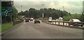
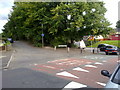
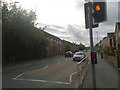
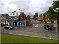
100 photos from this area
Area Information
Key information about the BL9 7EA including its size, population, and administrative classification.
- Area Type
- Postcode
- Area Size
- 1.5 hectares
- Population
- 2193
- Population Density
- 9340 people/km²
House Prices in BL9 7EA
47
Properties
£89,358
Average Sold Price
£25,000
Lowest Price
£170,000
Highest Price
Showing 47 properties
| Address | Type | Beds | Baths | Last Sale Price | Last Sale Date | |
|---|---|---|---|---|---|---|
| 88 Heywood Street, Bury, BL9 7EA | Terraced | 3 | 1 | £150,000 | Mar 2021 | |
| 44 Heywood Street, Bury, BL9 7EA | Terraced | 2 | 1 | £125,000 | Nov 2019 | |
| Santal House, 38 Heywood Street, Bury, BL9 7EA | Semi-detached | 2 | 1 | £115,000 | Jan 2018 | |
| 72 Heywood Street, Bury, BL9 7EA | house | - | - | £85,000 | Nov 2017 | |
| 48 Heywood Street, Bury, BL9 7EA | Semi-detached | 2 | 1 | £92,000 | Jul 2017 | |
| 80 Heywood Street, Bury, BL9 7EA | house | - | - | £115,000 | Jul 2017 | |
| 84 Heywood Street, Bury, BL9 7EA | house | - | - | £75,000 | Dec 2016 | |
| 52 Heywood Street, Bury, BL9 7EA | house | 2 | - | £82,000 | Oct 2012 | |
| 16 Heywood Street, Bury, BL9 7EA | Terraced | 2 | 1 | £150,000 | Jan 2012 | |
| 78 Heywood Street, Bury, BL9 7EA | Terraced | - | - | £115,000 | Apr 2009 |
Page 1 of 5
Energy Efficiency in BL9 7EA
Amenities
Schools
| Rank | School | Type | Entry gender | Ages |
|---|
Explore more schools in this area
Go to Schools tabDemographics
Household Size
Family (3-5 people)
most common
Accommodation Type
Houses
most common
Tenure
65
majority
Ethnic Group
asian_total
most common
Religion
N/A
most common
Household Composition
N/A
most common
Age
47
median
Adults (30-64 years)
most common
Household Deprivation
N/A
with no deprivation
NS-SEC
17
in Lower managerial occupations
Explore more demographic insights in this area
Go to Demographics tabPlanning
Planning Constraints
- Flood RiskPremium
- Ramsar Wetland SitesPremium
- Area of Outstanding Natural BeautyPremium
- Protected Nature ReservePremium
- Protected WoodlandPremium