Area Overview for BL9 7DQ
Photos of BL9 7DQ

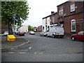
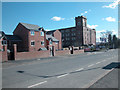
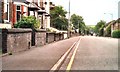
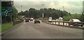
100 photos from this area
Area Information
Key information about the BL9 7DQ including its size, population, and administrative classification.
- Area Type
- Postcode
- Area Size
- 3665 m²
- Population
- 1734
- Population Density
- 7871 people/km²
House Prices in BL9 7DQ
31
Properties
£94,181
Average Sold Price
£16,950
Lowest Price
£170,000
Highest Price
Showing 31 properties
| Address | Type | Beds | Baths | Last Sale Price | Last Sale Date | |
|---|---|---|---|---|---|---|
| 245 Wash Lane Terrace, Bury, BL9 7DQ | house | 2 | 1 | £170,000 | Oct 2023 | |
| 263 Wash Lane Terrace, Bury, BL9 7DQ | house | - | - | £120,000 | Mar 2023 | |
| 265 Wash Lane Terrace, Bury, BL9 7DQ | house | - | - | £150,000 | Oct 2022 | |
| 239 Wash Lane Terrace, Bury, BL9 7DQ | house | - | - | £105,000 | Mar 2021 | |
| 259 Wash Lane Terrace, Bury, BL9 7DQ | Terraced | 2 | 1 | £101,000 | Sep 2019 | |
| 241 Wash Lane Terrace, Bury, BL9 7DQ | house | - | - | £52,500 | Aug 2003 | |
| 255 Wash Lane Terrace, Bury, BL9 7DQ | house | - | - | £37,995 | Feb 2003 | |
| 247 Wash Lane Terrace, Bury, BL9 7DQ | Retail | 2 | 1 | £16,950 | Nov 1997 | |
| 239 Wash Lane, Bury, BL9 7DQ | Semi-detached | - | - | - | - | |
| 249 Wash Lane, Bury, BL9 7DQ | Semi-detached | - | - | - | - |
Page 1 of 4
Energy Efficiency in BL9 7DQ
Amenities
Schools
| Rank | School | Type | Entry gender | Ages |
|---|
Explore more schools in this area
Go to Schools tabDemographics
Household Size
Family (3-5 people)
most common
Accommodation Type
Houses
most common
Tenure
49
majority
Ethnic Group
White
most common
Religion
N/A
most common
Household Composition
N/A
most common
Age
47
median
Adults (30-64 years)
most common
Household Deprivation
N/A
with no deprivation
NS-SEC
19
in Lower managerial occupations
Explore more demographic insights in this area
Go to Demographics tabPlanning
Planning Constraints
- Flood RiskPremium
- Ramsar Wetland SitesPremium
- Area of Outstanding Natural BeautyPremium
- Protected Nature ReservePremium
- Protected WoodlandPremium