Area Overview for BL9 6SD
Photos of BL9 6SD
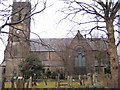
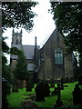
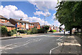
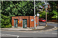
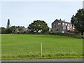
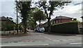
23 photos from this area
Area Information
Key information about the BL9 6SD including its size, population, and administrative classification.
- Area Type
- Postcode
- Area Size
- 5227 m²
- Population
- 1488
- Population Density
- 1113 people/km²
House Prices in BL9 6SD
16
Properties
£136,425
Average Sold Price
£750
Lowest Price
£340,000
Highest Price
Showing 16 properties
| Address | Type | Beds | Baths | Last Sale Price | Last Sale Date | |
|---|---|---|---|---|---|---|
| 47 Walmersley Old Road, Bury, BL9 6SD | house | 3 | - | £185,000 | Dec 2021 | |
| 27 Walmersley Old Road, Bury, BL9 6SD | Detached | 4 | 2 | £340,000 | Mar 2021 | |
| 35 Walmersley Old Road, Bury, BL9 6SD | Detached | - | - | £750 | Jan 2021 | |
| 37 Walmersley Old Road, Bury, BL9 6SD | Detached | 3 | 1 | £178,000 | Mar 2016 | |
| 1A Walmersley Old Road, Bury, BL9 6SD | Detached | 3 | 1 | £139,000 | Aug 2015 | |
| 39 Walmersley Old Road, Bury, BL9 6SD | house | - | - | £134,000 | Nov 2013 | |
| 19 Walmersley Old Road, Bury, BL9 6SD | house | - | - | £121,000 | Jul 2013 | |
| 3 Walmersley Old Road, Bury, BL9 6SD | Semi-detached | - | - | £132,500 | Nov 2012 | |
| 21 Walmersley Old Road, Bury, BL9 6SD | Terraced | - | - | £85,000 | Jul 2002 | |
| 49 Walmersley Old Road, Bury, BL9 6SD | Semi-detached | 3 | 1 | £49,000 | Aug 1998 |
Page 1 of 2
Energy Efficiency in BL9 6SD
Amenities
Schools
| Rank | School | Type | Entry gender | Ages |
|---|
Explore more schools in this area
Go to Schools tabDemographics
Household Size
Two person
most common
Accommodation Type
Houses
most common
Tenure
86
majority
Ethnic Group
White
most common
Religion
N/A
most common
Household Composition
N/A
most common
Age
47
median
Adults (30-64 years)
most common
Household Deprivation
N/A
with no deprivation
NS-SEC
41
in Lower managerial occupations
Explore more demographic insights in this area
Go to Demographics tabPlanning
Planning Constraints
- Flood RiskPremium
- Ramsar Wetland SitesPremium
- Area of Outstanding Natural BeautyPremium
- Protected Nature ReservePremium
- Protected WoodlandPremium