Area Overview for BL9 5EF
Photos of BL9 5EF
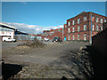
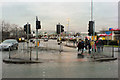
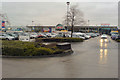
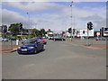
88 photos from this area
Area Information
Key information about the BL9 5EF including its size, population, and administrative classification.
- Area Type
- Postcode
- Area Size
- 2641 m²
- Population
- 1812
- Population Density
- 686200 people/km²
House Prices in BL9 5EF
9
Properties
£97,000
Average Sold Price
£60,000
Lowest Price
£156,500
Highest Price
Showing 9 properties
| Address | Type | Beds | Baths | Last Sale Price | Last Sale Date | |
|---|---|---|---|---|---|---|
| 251 Hornby Street, Bury, BL9 5EF | Semi-detached | 3 | 1 | £156,500 | Jul 2023 | |
| 257 Hornby Street, Bury, BL9 5EF | Semi-detached | 3 | - | £95,000 | Jul 2015 | |
| 261 Hornby Street, Bury, BL9 5EF | Semi-detached | 3 | 2 | £75,000 | Sep 2011 | |
| 255 Hornby Street, Bury, BL9 5EF | house | 3 | 2 | £60,000 | Sep 2009 | |
| 263 Hornby Street, Bury, BL9 5EF | Semi-detached | 3 | 1 | £98,500 | Apr 2005 | |
| 253 Hornby Street, Bury, BL9 5EF | Semi-detached | 3 | - | - | - | |
| H M R Cars, Fernhill Mill, Hornby Street, Bury, BL9 5EF | Industrial | - | - | - | - | |
| 259 Hornby Street, Bury, BL9 5EF | Semi-detached | - | - | - | - | |
| The Returns Box, Fernhill Mill, Hornby Street, Bury, BL9 5EF | office_workshop | - | - | - | - |
Energy Efficiency in BL9 5EF
Amenities
Schools
| Rank | School | Type | Entry gender | Ages |
|---|
Explore more schools in this area
Go to Schools tabDemographics
Household Size
Family (3-5 people)
most common
Accommodation Type
Houses
most common
Tenure
37
majority
Ethnic Group
White
most common
Religion
N/A
most common
Household Composition
N/A
most common
Age
47
median
Adults (30-64 years)
most common
Household Deprivation
N/A
with no deprivation
NS-SEC
12
in Lower managerial occupations
Explore more demographic insights in this area
Go to Demographics tabPlanning
Planning Constraints
- Flood RiskPremium
- Ramsar Wetland SitesPremium
- Area of Outstanding Natural BeautyPremium
- Protected Nature ReservePremium
- Protected WoodlandPremium