Area Overview for BL9 5DS
Photos of BL9 5DS
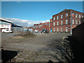
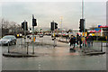
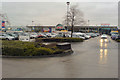
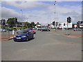

88 photos from this area
Area Information
Key information about the BL9 5DS including its size, population, and administrative classification.
- Area Type
- Postcode
- Area Size
- 7058 m²
- Population
- 1857
- Population Density
- 5243 people/km²
House Prices in BL9 5DS
39
Properties
£86,477
Average Sold Price
£22,000
Lowest Price
£164,000
Highest Price
Showing 39 properties
| Address | Type | Beds | Baths | Last Sale Price | Last Sale Date | |
|---|---|---|---|---|---|---|
| 292 Hornby Street, Bury, BL9 5DS | Terraced | 2 | 1 | £164,000 | Jul 2025 | |
| 320 Hornby Street, Bury, BL9 5DS | Terraced | 2 | 1 | £147,000 | Aug 2024 | |
| 288 Hornby Street, Bury, BL9 5DS | Terraced | 2 | 1 | £150,000 | Jan 2024 | |
| 284 Hornby Street, Bury, BL9 5DS | Retail | 2 | 1 | £135,000 | Jul 2022 | |
| 322 Hornby Street, Bury, BL9 5DS | Terraced | 3 | 1 | £105,000 | Jan 2020 | |
| 268 Hornby Street, Bury, BL9 5DS | Terraced | 3 | 1 | £102,500 | Jan 2019 | |
| 324 Hornby Street, Bury, BL9 5DS | Terraced | 3 | 1 | £75,000 | Nov 2016 | |
| 326 Hornby Street, Bury, BL9 5DS | Terraced | 2 | 1 | £104,000 | Mar 2016 | |
| 274 Hornby Street, Bury, BL9 5DS | Terraced | 2 | - | £85,000 | Aug 2015 | |
| 328 Hornby Street, Bury, BL9 5DS | Terraced | 1 | 1 | £75,000 | Jul 2014 |
Page 1 of 4
Energy Efficiency in BL9 5DS
Amenities
Schools
| Rank | School | Type | Entry gender | Ages |
|---|
Explore more schools in this area
Go to Schools tabDemographics
Household Size
Family (3-5 people)
most common
Accommodation Type
Houses
most common
Tenure
71
majority
Ethnic Group
White
most common
Religion
N/A
most common
Household Composition
N/A
most common
Age
47
median
Adults (30-64 years)
most common
Household Deprivation
N/A
with no deprivation
NS-SEC
28
in Lower managerial occupations
Explore more demographic insights in this area
Go to Demographics tabPlanning
Planning Constraints
- Flood RiskPremium
- Ramsar Wetland SitesPremium
- Area of Outstanding Natural BeautyPremium
- Protected Nature ReservePremium
- Protected WoodlandPremium