Area Overview for BL9 5DF
Photos of BL9 5DF
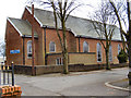
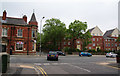
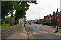
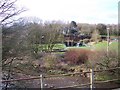
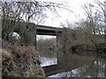
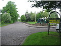


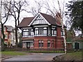
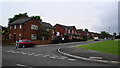
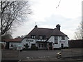
62 photos from this area
Area Information
Key information about the BL9 5DF including its size, population, and administrative classification.
- Area Type
- Postcode
- Area Size
- 1.0 hectares
- Population
- 1857
- Population Density
- 5243 people/km²
House Prices in BL9 5DF
63
Properties
£190,867
Average Sold Price
£3,500
Lowest Price
£320,000
Highest Price
Showing 63 properties
| Address | Type | Beds | Baths | Last Sale Price | Last Sale Date | |
|---|---|---|---|---|---|---|
| 193 Walmersley Road, Bury, BL9 5DF | Terraced | 3 | - | £200,000 | Nov 2023 | |
| 221 Walmersley Road, Bury, BL9 5DF | house | - | - | £250,000 | Sep 2023 | |
| 189 Walmersley Road, Bury, BL9 5DF | Retail | 5 | 1 | £305,000 | May 2022 | |
| 195 Walmersley Road, Bury, BL9 5DF | house | 5 | - | £305,000 | Sep 2021 | |
| 209 Walmersley Road, Bury, BL9 5DF | house | - | - | £320,000 | Jun 2021 | |
| 197 Walmersley Road, Bury, BL9 5DF | house | - | - | £210,000 | Jun 2021 | |
| 223 Walmersley Road, Bury, BL9 5DF | Semi-detached | 6 | 1 | £285,000 | Oct 2020 | |
| 211 Walmersley Road, Bury, BL9 5DF | Semi-detached | 5 | 3 | £315,000 | Aug 2017 | |
| 203 Walmersley Road, Bury, BL9 5DF | house | - | - | £3,500 | Feb 2017 | |
| 205 Walmersley Road, Bury, BL9 5DF | Semi-detached | 5 | 3 | £238,000 | Jun 2016 |
Page 1 of 7
Energy Efficiency in BL9 5DF
Amenities
Schools
| Rank | School | Type | Entry gender | Ages |
|---|
Explore more schools in this area
Go to Schools tabDemographics
Household Size
Family (3-5 people)
most common
Accommodation Type
Houses
most common
Tenure
71
majority
Ethnic Group
White
most common
Religion
N/A
most common
Household Composition
N/A
most common
Age
47
median
Adults (30-64 years)
most common
Household Deprivation
N/A
with no deprivation
NS-SEC
28
in Lower managerial occupations
Explore more demographic insights in this area
Go to Demographics tabPlanning
Planning Constraints
- Flood RiskPremium
- Ramsar Wetland SitesPremium
- Area of Outstanding Natural BeautyPremium
- Protected Nature ReservePremium
- Protected WoodlandPremium